
Parks & local places
community trails · open spaces. Check the route and public access from the home you’re considering.
A local guide to everyday life
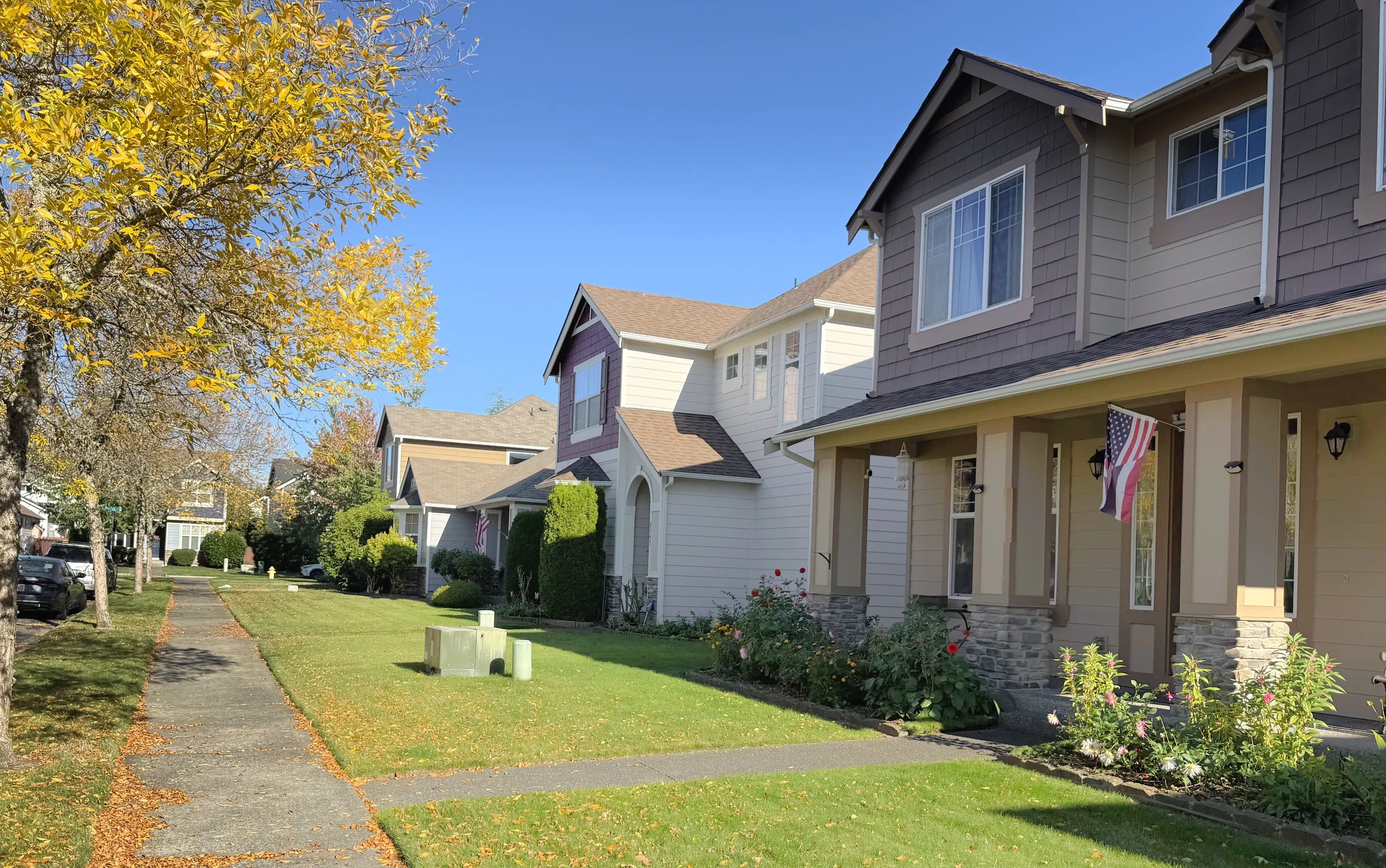
A specific northeast-Lacey planned community within the larger Hawks Prairie geography, known for newer homes, golf-course edges, trails and organized residential pockets.
Planned-community detached homes and townhomes
Cohesive appearance may limit exterior changes or parking choices.
Start with the address
School boundaries can differ from city limits, mailing addresses and neighborhood names. Check the specific home before relying on an assignment.
Open the county’s Elections and Schools Map or Property Map. Search the address, then confirm the result with the district.
Find Your School: follow the district’s address-search instructions. This is a regional starting point, not a confirmed assignment for Meridian Campus.
An ordinary week
community trails · open spaces. Check the route and public access from the home you’re considering.
Compare groceries, pharmacy stops and your other regular errands from the actual driveway. Check store hours and the trip at the time you normally go.
Willamette Drive · Marvin Road · 41st Avenue · Hawks Prairie Road · I-5. Test the connection from your street at your actual travel hours.
When you’re ready to look
Live listings are not connected
A verified property search can be added here once a provider and search area are selected. There are no live listing results on this page.
See the place
Original photographs by Kyle Murphy. Open a thumbnail for the full view and location caption.
Only if you want the deeper dive
Street-level photos, local history and the detailed housing research are here when you need them.
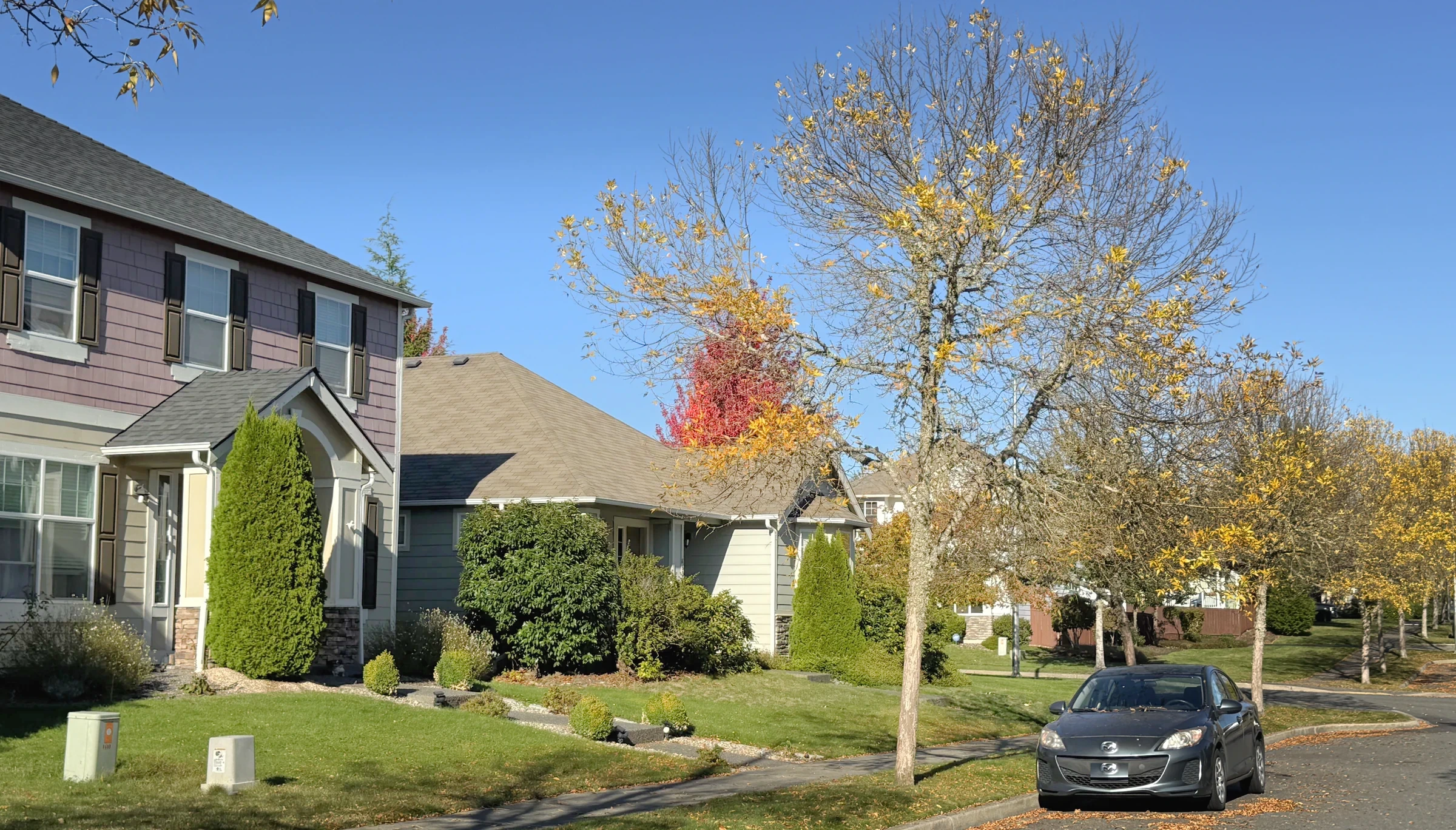
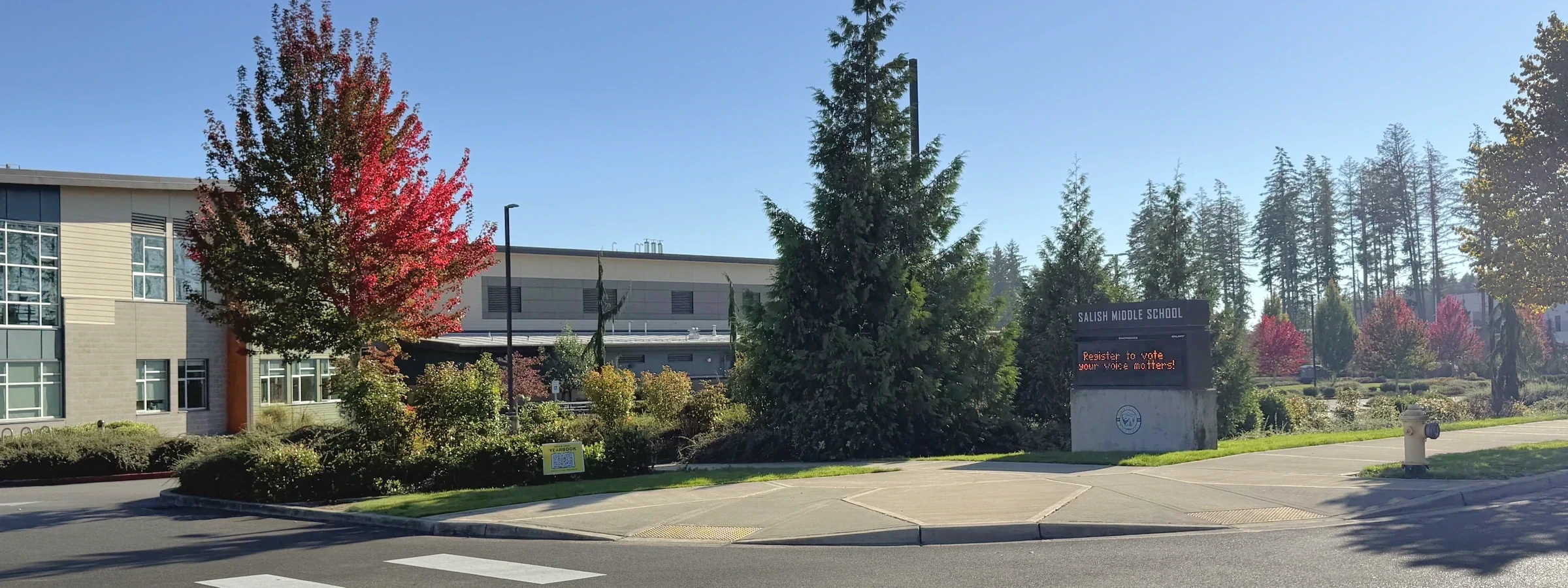
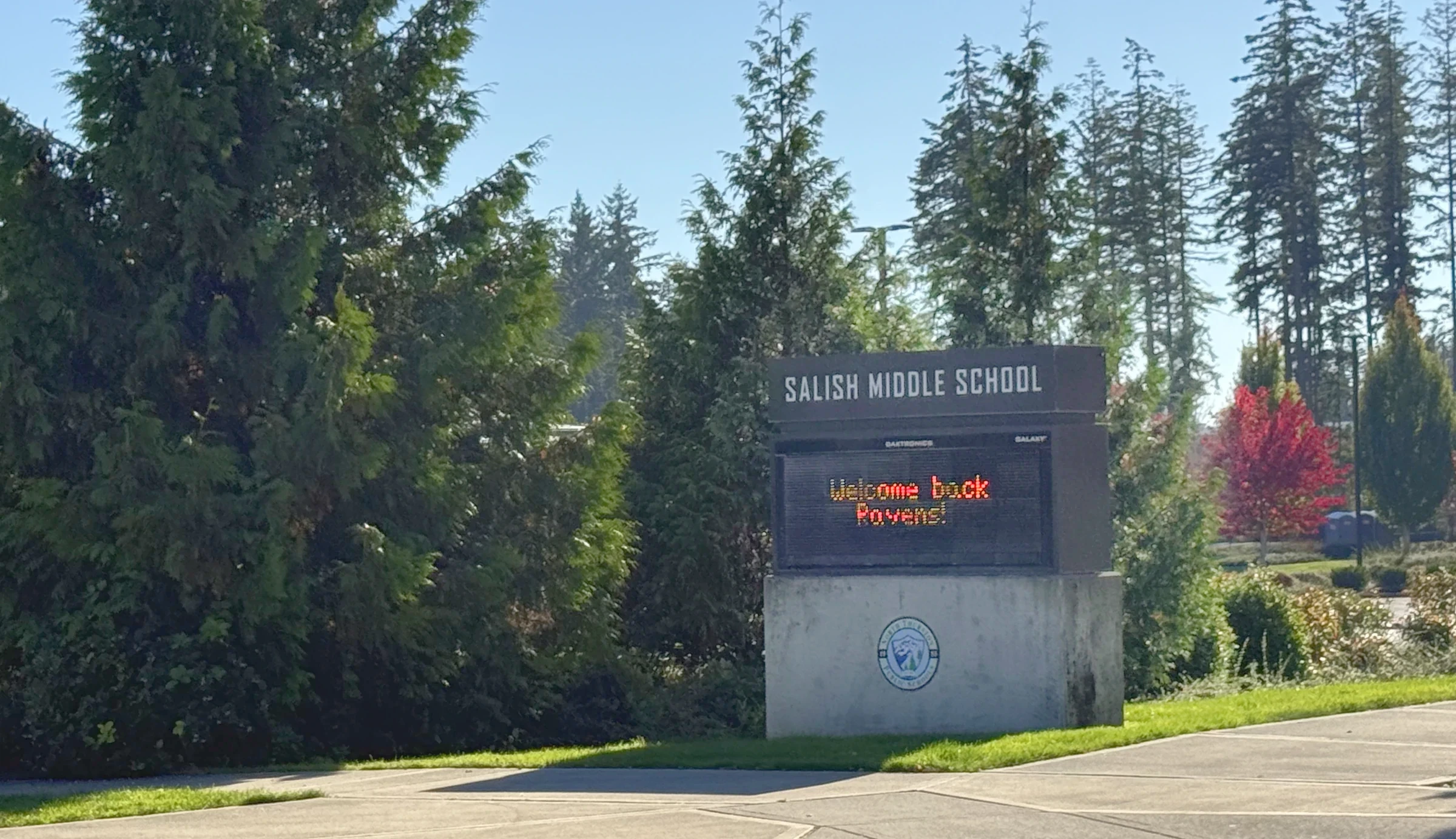
Get to know the streets
Explore local streets and landmarks. Pins orient you to the area; shaded outlines are city-mapped associations, not the boundaries of this browsing region.
The local map in plain English
Verified builder research · October 15, 2026
Other builders may also have contributed; not all home and phase records have been reconciled. Property-level evidence applies to the named property, and community evidence applies only to the documented offering or phase.
documented community or phase only
Source 1 ↗Download the countywide verified property evidence (CSV) ↓ · Coverage & attribution method →
Inside the larger Hawks Prairie map
Meridian Campus occupies a specific planned area around Willamette Drive and the golf-course landscape. The streets, open spaces and building eras feel more coordinated than the broad retail-and-employment geography people call Hawks Prairie.
That distinction helps a buyer compare accurately. A Meridian Campus home should be evaluated against its own plat, association and lot context—not against every listing using the Hawks Prairie label.
A landscaped daily rhythm
Walking routes, open spaces and golf-course edges create a quieter internal experience. Groceries and services remain close, while trips south or north depend on Willamette, Marvin and the I-5 interchange.
The second visit should include the property at an active golf or commute time. Lot position can affect privacy, stray-ball exposure, maintenance and road noise in ways a floor plan cannot show.
Compare this local guide with the other neighborhoods and pockets in its wider area.
A closer look inside Hawks Prairie
These local profiles surface a useful contrast in construction history, development or property responsibilities. Open the source notes before applying a community-level fact to a specific address.
History & construction
The county research keeps 3 recorded-name groups separate. “CAMPUS ESTATES DIV 3” has 43 county records with a year built from 2020–2023, median 2021; sampled residential lots have a 0.19-acre median (43 observations); “CAMPUS ESTATES DIVISION 2” has 37 county records with a year built from 2016–2021, median 2017; sampled residential lots have a 0.21-acre median (37 observations). These assessor samples help compare building eras, but do not establish the first or last home in a subdivision or the permit history of an individual address. 1 additional groups appear in the table below.
Open this place profile →Builders & development stages
Rob Rice Homes (marketed brand)
Open this place profile →Inside Hawks Prairie
Compare each place on its own. Builder history, house age, style and ownership arrangements can change between neighboring streets. Recorded-name groups and dated development projects are labeled separately from established communities.
Subdivision · Meridian Campus
A separately marketed Rob Rice community within Meridian Campus.
Sampled buildings; not a complete buildout history.
Documented builder(s): Rob Rice Homes (marketed brand)
Other builders may also have contributed; not all home and phase records have been reconciled.
Other builders may also have contributed; not all home and phase records have been reconciled. The documented attribution applies only to the community, offering or phase identified above.
October 10, 2026 research snapshot. These are legal-description search groups, not a count of homes or certified plat boundaries. Divisions, phases and similarly named records remain separate. Year-built fields can include later replacement buildings and non-house property types.
| Recorded name | Year-built sample | Residential lot sample |
|---|---|---|
| CAMPUS ESTATES DIV 120 named parcel observations | 2015–201615 year observations · median 2015 | 0.19 acres median15 acreage observations |
| CAMPUS ESTATES DIV 346 named parcel observations | 2020–202343 year observations · median 2021 | 0.19 acres median43 acreage observations |
| CAMPUS ESTATES DIVISION 243 named parcel observations | 2016–202137 year observations · median 2017 | 0.21 acres median37 acreage observations |
Acreage is the median of positive lot-size observations below 100 acres coded RES in the research, not a measurement of every home lot. Samples can be incomplete or overlap; do not add them to calculate community totals. Confirm the actual parcel, original permit, additions and recorded map before relying on a date or size.
Evidence: community documented. Development dates, association formation and individual home completion are separate facts. Research updated October 10, 2026.
Subdivision · Meridian Campus
A named subdivision near Campus Glen Drive and Willamette Drive.
Sampled buildings; not a complete buildout history.
October 10, 2026 research snapshot. These are legal-description search groups, not a count of homes or certified plat boundaries. Divisions, phases and similarly named records remain separate. Year-built fields can include later replacement buildings and non-house property types.
| Recorded name | Year-built sample | Residential lot sample |
|---|---|---|
| CAMPUS GLEN119 named parcel observations | 2005–2006114 year observations · median 2006 | 0.11 acres median114 acreage observations |
| CAMPUS GLEN DIV 259 named parcel observations | 2005–200658 year observations · median 2006 | 0.12 acres median58 acreage observations |
Acreage is the median of positive lot-size observations below 100 acres coded RES in the research, not a measurement of every home lot. Samples can be incomplete or overlap; do not add them to calculate community totals. Confirm the actual parcel, original permit, additions and recorded map before relying on a date or size.
Evidence: planning record. Development dates, association formation and individual home completion are separate facts. Research updated October 10, 2026.
Plat records
County parcel records identify Campus Highlands around ELLSWORTH CT NE, CAMERON DR NE, AMELIA CT NE. Related record names and divisions remain separate until their original maps and governing documents establish the relationship.
2 additional recorded groups in the profile. Sampled buildings; not a complete buildout history.
October 10, 2026 research snapshot. These are legal-description search groups, not a count of homes or certified plat boundaries. Divisions, phases and similarly named records remain separate. Year-built fields can include later replacement buildings and non-house property types.
| Recorded name | Year-built sample | Residential lot sample |
|---|---|---|
| CAMPUS HIGHLANDS DIV 141 named parcel observations | 2006–201038 year observations · median 2007 | 0.17 acres median38 acreage observations |
| CAMPUS HIGHLANDS DIV 213 named parcel observations | 2006–200713 year observations · median 2006 | 0.15 acres median13 acreage observations |
| CAMPUS HIGHLANDS DIV 331 named parcel observations | 2007–201330 year observations · median 2008 | 0.17 acres median30 acreage observations |
| CAMPUS HIGHLANDS DIV 442 named parcel observations | 2007–201241 year observations · median 2007 | 0.16 acres median41 acreage observations |
| CAMPUS HIGHLANDS DIV 576 named parcel observations | 2012–201471 year observations · median 2012 | 0.16 acres median71 acreage observations |
Acreage is the median of positive lot-size observations below 100 acres coded RES in the research, not a measurement of every home lot. Samples can be incomplete or overlap; do not add them to calculate community totals. Confirm the actual parcel, original permit, additions and recorded map before relying on a date or size.
Evidence: parcel records. Development dates, association formation and individual home completion are separate facts. Research updated October 10, 2026.
Plat records
County parcel records identify Campus Meadows around CAMPUS GLEN DR NE, STEVENS CT NE, SNOWBERRY ST NE, LUPINE ST NE. Related record names and divisions remain separate until their original maps and governing documents establish the relationship.
1 additional recorded groups in the profile. Sampled buildings; not a complete buildout history.
October 10, 2026 research snapshot. These are legal-description search groups, not a count of homes or certified plat boundaries. Divisions, phases and similarly named records remain separate. Year-built fields can include later replacement buildings and non-house property types.
| Recorded name | Year-built sample | Residential lot sample |
|---|---|---|
| CAMPUS MEADOWS3 named parcel observations | 2010–20112 year observations · median 2010.5 | 0.285 acres median2 acreage observations |
| CAMPUS MEADOWS DIV 178 named parcel observations | 2007–201078 year observations · median 2007 | 0.12 acres median78 acreage observations |
| CAMPUS MEADOWS DIV 263 named parcel observations | 2008–201061 year observations · median 2008 | 0.12 acres median61 acreage observations |
| CAMPUS MEADOWS DIV 326 named parcel observations | 2010–201225 year observations · median 2011 | 0.115 acres median26 acreage observations |
Acreage is the median of positive lot-size observations below 100 acres coded RES in the research, not a measurement of every home lot. Samples can be incomplete or overlap; do not add them to calculate community totals. Confirm the actual parcel, original permit, additions and recorded map before relying on a date or size.
Evidence: parcel records. Development dates, association formation and individual home completion are separate facts. Research updated October 10, 2026.
Plat records
County parcel records identify Campus Park around DRAKE CT NE, BARKLAY RD NE, STEVENS DR NE. Related record names and divisions remain separate until their original maps and governing documents establish the relationship.
Sampled buildings; not a complete buildout history.
October 10, 2026 research snapshot. These are legal-description search groups, not a count of homes or certified plat boundaries. Divisions, phases and similarly named records remain separate. Year-built fields can include later replacement buildings and non-house property types.
| Recorded name | Year-built sample | Residential lot sample |
|---|---|---|
| CAMPUS PARK138 named parcel observations | 1994–2010134 year observations · median 1998 | 0.19 acres median134 acreage observations |
| CAMPUS PARK PH 11 named parcel observations | 19951 year observations · median 1995 | 0.24 acres median1 acreage observations |
Acreage is the median of positive lot-size observations below 100 acres coded RES in the research, not a measurement of every home lot. Samples can be incomplete or overlap; do not add them to calculate community totals. Confirm the actual parcel, original permit, additions and recorded map before relying on a date or size.
Evidence: parcel records. Development dates, association formation and individual home completion are separate facts. Research updated October 10, 2026.
Subdivision · Meridian Campus
A distinct Rob Rice community within the master plan.
Sampled buildings; not a complete buildout history.
Documented builder(s): Rob Rice Homes (marketed brand)
Other builders may also have contributed; not all home and phase records have been reconciled.
Housing detail: Published two-story plans, 2,385–2,692 sq ft; verify phase and lot.
Other builders may also have contributed; not all home and phase records have been reconciled. The documented attribution applies only to the community, offering or phase identified above.
October 10, 2026 research snapshot. These are legal-description search groups, not a count of homes or certified plat boundaries. Divisions, phases and similarly named records remain separate. Year-built fields can include later replacement buildings and non-house property types.
| Recorded name | Year-built sample | Residential lot sample |
|---|---|---|
| CAMPUS PEAK100 named parcel observations | 2015–202190 year observations · median 2017 | 0.09 acres median90 acreage observations |
Acreage is the median of positive lot-size observations below 100 acres coded RES in the research, not a measurement of every home lot. Samples can be incomplete or overlap; do not add them to calculate community totals. Confirm the actual parcel, original permit, additions and recorded map before relying on a date or size.
Evidence: community documented. Development dates, association formation and individual home completion are separate facts. Research updated October 10, 2026.
Subdivision · Meridian Campus
Campus Pointe is included in our Hawks Prairie guide. County records in the “CAMPUS POINTE” sample include 106 buildings dated 2007–2013, with sampled addresses on LONDON LOOP NE. This is a snapshot, not the complete neighborhood buildout.
Sampled buildings; not a complete buildout history.
October 10, 2026 research snapshot. These are legal-description search groups, not a count of homes or certified plat boundaries. Divisions, phases and similarly named records remain separate. Year-built fields can include later replacement buildings and non-house property types.
| Recorded name | Year-built sample | Residential lot sample |
|---|---|---|
| CAMPUS POINTE111 named parcel observations | 2007–2013106 year observations · median 2011 | 0.09 acres median106 acreage observations |
Acreage is the median of positive lot-size observations below 100 acres coded RES in the research, not a measurement of every home lot. Samples can be incomplete or overlap; do not add them to calculate community totals. Confirm the actual parcel, original permit, additions and recorded map before relying on a date or size.
Evidence: planning record. Development dates, association formation and individual home completion are separate facts. Research updated October 10, 2026.
Subdivision · Meridian Campus
A separately named Campus development; check phase and association.
Documented builder(s): Lennar for the documented Campus Reserve townhome offering; detached phases remain unverified
Other builders may also have contributed; not all home and phase records have been reconciled.
Other builders may also have contributed; not all home and phase records have been reconciled. The documented attribution applies only to the community, offering or phase identified above.
Evidence: planning record. Development dates, association formation and individual home completion are separate facts.
Plat records
County parcel records identify Classic Heights around MERCEDES DR NE, BEEMER CT NE, NE JAGUAR CT, JAGUAR CT NE. Related record names and divisions remain separate until their original maps and governing documents establish the relationship.
Sampled buildings; not a complete buildout history.
October 10, 2026 research snapshot. These are legal-description search groups, not a count of homes or certified plat boundaries. Divisions, phases and similarly named records remain separate. Year-built fields can include later replacement buildings and non-house property types.
| Recorded name | Year-built sample | Residential lot sample |
|---|---|---|
| CLASSIC HEIGHTS DIV 140 named parcel observations | 1990–199240 year observations · median 1991 | 0.25 acres median40 acreage observations |
| CLASSIC HEIGHTS DIV 260 named parcel observations | 1992–199560 year observations · median 1993 | 0.27 acres median60 acreage observations |
Acreage is the median of positive lot-size observations below 100 acres coded RES in the research, not a measurement of every home lot. Samples can be incomplete or overlap; do not add them to calculate community totals. Confirm the actual parcel, original permit, additions and recorded map before relying on a date or size.
Evidence: parcel records. Development dates, association formation and individual home completion are separate facts. Research updated October 10, 2026.
Plat records
County parcel records identify Continental Crest around JERI DR NE. Related record names and divisions remain separate until their original maps and governing documents establish the relationship.
Sampled buildings; not a complete buildout history.
October 10, 2026 research snapshot. These are legal-description search groups, not a count of homes or certified plat boundaries. Divisions, phases and similarly named records remain separate. Year-built fields can include later replacement buildings and non-house property types.
| Recorded name | Year-built sample | Residential lot sample |
|---|---|---|
| CONTINENTAL CREST132 named parcel observations | 1994–1996131 year observations · median 1995 | 0.18 acres median131 acreage observations |
Acreage is the median of positive lot-size observations below 100 acres coded RES in the research, not a measurement of every home lot. Samples can be incomplete or overlap; do not add them to calculate community totals. Confirm the actual parcel, original permit, additions and recorded map before relying on a date or size.
Evidence: parcel records. Development dates, association formation and individual home completion are separate facts. Research updated October 10, 2026.
Subdivision
A separate community within Hawks Prairie Community Association, distinct from Jubilee.
Evidence: community documented. Development dates, association formation and individual home completion are separate facts.
Plat records
County parcel records identify Foxhall around FOXHALL DR NE, ARROW CT NE. Related record names and divisions remain separate until their original maps and governing documents establish the relationship.
Sampled buildings; not a complete buildout history.
Amenities: The local association owns/mows bridle trails and maintains playgrounds. Trails are for residents; playground use extends to members, families and accompanied guests. These are not public recreation facilities.Source ↗
October 10, 2026 research snapshot. These are legal-description search groups, not a count of homes or certified plat boundaries. Divisions, phases and similarly named records remain separate. Year-built fields can include later replacement buildings and non-house property types.
| Recorded name | Year-built sample | Residential lot sample |
|---|---|---|
| FOXHALL4 named parcel observations | 1984–19864 year observations · median 1986 | 0.93 acres median4 acreage observations |
| FOXHALL DIV 131 named parcel observations | 1981–199127 year observations · median 1984 | 0.845 acres median28 acreage observations |
| FOXHALL DIV 21 named parcel observations | 19881 year observations · median 1988 | 4.33 acres median1 acreage observations |
Acreage is the median of positive lot-size observations below 100 acres coded RES in the research, not a measurement of every home lot. Samples can be incomplete or overlap; do not add them to calculate community totals. Confirm the actual parcel, original permit, additions and recorded map before relying on a date or size.
Evidence: parcel records. Development dates, association formation and individual home completion are separate facts. Research updated October 10, 2026.
Plat records
County parcel records identify Gateway Div 2A around SAGA CT NE, CASSIUS ST NE, KACIE CT NE. Related record names and divisions remain separate until their original maps and governing documents establish the relationship.
Sampled buildings; not a complete buildout history.
October 10, 2026 research snapshot. These are legal-description search groups, not a count of homes or certified plat boundaries. Divisions, phases and similarly named records remain separate. Year-built fields can include later replacement buildings and non-house property types.
| Recorded name | Year-built sample | Residential lot sample |
|---|---|---|
| GATEWAY DIV 2A PH 129 named parcel observations | 201824 year observations · median 2018 | 0.14 acres median24 acreage observations |
| GATEWAY DIV 2A PH 21 named parcel observations | Not established | Not established |
| GATEWAY DIV 2A PH 3107 named parcel observations | 2019–202098 year observations · median 2019 | 0.11 acres median98 acreage observations |
Acreage is the median of positive lot-size observations below 100 acres coded RES in the research, not a measurement of every home lot. Samples can be incomplete or overlap; do not add them to calculate community totals. Confirm the actual parcel, original permit, additions and recorded map before relying on a date or size.
Evidence: parcel records. Development dates, association formation and individual home completion are separate facts. Research updated October 10, 2026.
Plat records
County parcel records identify Gateway Div 2B around FIDDLEBACK ST NE, MAHOGANY ST NE. Related record names and divisions remain separate until their original maps and governing documents establish the relationship.
Sampled buildings; not a complete buildout history.
October 10, 2026 research snapshot. These are legal-description search groups, not a count of homes or certified plat boundaries. Divisions, phases and similarly named records remain separate. Year-built fields can include later replacement buildings and non-house property types.
| Recorded name | Year-built sample | Residential lot sample |
|---|---|---|
| GATEWAY DIV 2B154 named parcel observations | 2019–2021146 year observations · median 2020 | 0.12 acres median146 acreage observations |
Acreage is the median of positive lot-size observations below 100 acres coded RES in the research, not a measurement of every home lot. Samples can be incomplete or overlap; do not add them to calculate community totals. Confirm the actual parcel, original permit, additions and recorded map before relying on a date or size.
Evidence: parcel records. Development dates, association formation and individual home completion are separate facts. Research updated October 10, 2026.
Plat records
County parcel records identify Hawks Prairie · recorded divisions around TRADITIONS AVE NE, GREENVIEW DR NE, CASHMERE DR NE, EDGEWATER BLVD NE. Related record names and divisions remain separate until their original maps and governing documents establish the relationship.
2 additional recorded groups in the profile. Sampled buildings; not a complete buildout history.
October 10, 2026 research snapshot. These are legal-description search groups, not a count of homes or certified plat boundaries. Divisions, phases and similarly named records remain separate. Year-built fields can include later replacement buildings and non-house property types.
| Recorded name | Year-built sample | Residential lot sample |
|---|---|---|
| HAWKS PRAIRIE4 named parcel observations | 2007–20084 year observations · median 2007.5 | 0.125 acres median4 acreage observations |
| HAWKS PRAIRIE PH 1969 named parcel observations | 2004–2021945 year observations · median 2006 | 0.11 acres median945 acreage observations |
| HAWKS PRAIRIE PH 1 UNIT11 named parcel observations | 20041 year observations · median 2004 | 0.34 acres median1 acreage observations |
| HAWKS PRAIRIE PH 2437 named parcel observations | 2006–2016428 year observations · median 2009.5 | 0.11 acres median428 acreage observations |
| HAWKS PRAIRIE PH 383 named parcel observations | 2019–202268 year observations · median 2021 | 0.13 acres median68 acreage observations |
Acreage is the median of positive lot-size observations below 100 acres coded RES in the research, not a measurement of every home lot. Samples can be incomplete or overlap; do not add them to calculate community totals. Confirm the actual parcel, original permit, additions and recorded map before relying on a date or size.
Evidence: parcel records. Development dates, association formation and individual home completion are separate facts. Research updated October 10, 2026.
Plat records
County parcel records identify Jaylee around HEPBURN ST NE. Related record names and divisions remain separate until their original maps and governing documents establish the relationship.
Sampled buildings; not a complete buildout history.
October 10, 2026 research snapshot. These are legal-description search groups, not a count of homes or certified plat boundaries. Divisions, phases and similarly named records remain separate. Year-built fields can include later replacement buildings and non-house property types.
| Recorded name | Year-built sample | Residential lot sample |
|---|---|---|
| JAYLEE144 named parcel observations | 2008–2016142 year observations · median 2009.5 | 0.11 acres median142 acreage observations |
Acreage is the median of positive lot-size observations below 100 acres coded RES in the research, not a measurement of every home lot. Samples can be incomplete or overlap; do not add them to calculate community totals. Confirm the actual parcel, original permit, additions and recorded map before relying on a date or size.
Evidence: parcel records. Development dates, association formation and individual home completion are separate facts. Research updated October 10, 2026.
Subdivision
An age-restricted community with its own association identity.
Documented builder(s): Shea Homes; Century Communities for the Eagles Bluff collection
Other builders may also have contributed; not all home and phase records have been reconciled.
Shared rights & responsibilities: Confirm age restrictions, governing documents and amenities.
Other builders may also have contributed; not all home and phase records have been reconciled. The documented attribution applies only to the community, offering or phase identified above.
Evidence: community documented. Development dates, association formation and individual home completion are separate facts.
Master plan
The master-plan umbrella contains multiple separately named subdivisions.
Evidence: community documented. Development dates, association formation and individual home completion are separate facts.
Plat records
County parcel records identify Nisqually Place around STEPHANIE LOOP NE. Related record names and divisions remain separate until their original maps and governing documents establish the relationship.
Sampled buildings; not a complete buildout history.
Documented builder: Soundbuilt Homes markets Release 1. Other releases and underlying recorded plat identity require separate confirmation.Source ↗
Other builders may also have contributed; not all home and phase records have been reconciled.
Other builders may also have contributed; not all home and phase records have been reconciled. The documented attribution applies only to the community, offering or phase identified above.
October 10, 2026 research snapshot. These are legal-description search groups, not a count of homes or certified plat boundaries. Divisions, phases and similarly named records remain separate. Year-built fields can include later replacement buildings and non-house property types.
| Recorded name | Year-built sample | Residential lot sample |
|---|---|---|
| NISQUALLY PLACE53 named parcel observations | 2022–202446 year observations · median 2022.5 | 0.12 acres median46 acreage observations |
Acreage is the median of positive lot-size observations below 100 acres coded RES in the research, not a measurement of every home lot. Samples can be incomplete or overlap; do not add them to calculate community totals. Confirm the actual parcel, original permit, additions and recorded map before relying on a date or size.
Evidence: parcel records. Development dates, association formation and individual home completion are separate facts. Research updated October 10, 2026.
Plat records
County parcel records identify Raili May around BALI ST NE, MIA ST NE. Related record names and divisions remain separate until their original maps and governing documents establish the relationship.
Sampled buildings; not a complete buildout history.
October 10, 2026 research snapshot. These are legal-description search groups, not a count of homes or certified plat boundaries. Divisions, phases and similarly named records remain separate. Year-built fields can include later replacement buildings and non-house property types.
| Recorded name | Year-built sample | Residential lot sample |
|---|---|---|
| RAILI MAY154 named parcel observations | 2006–2008153 year observations · median 2007 | 0.12 acres median153 acreage observations |
Acreage is the median of positive lot-size observations below 100 acres coded RES in the research, not a measurement of every home lot. Samples can be incomplete or overlap; do not add them to calculate community totals. Confirm the actual parcel, original permit, additions and recorded map before relying on a date or size.
Evidence: parcel records. Development dates, association formation and individual home completion are separate facts. Research updated October 10, 2026.
Plat records
County parcel records identify Whidbey Passage around HERRON ST NE. Related record names and divisions remain separate until their original maps and governing documents establish the relationship.
Sampled buildings; not a complete buildout history.
October 10, 2026 research snapshot. These are legal-description search groups, not a count of homes or certified plat boundaries. Divisions, phases and similarly named records remain separate. Year-built fields can include later replacement buildings and non-house property types.
| Recorded name | Year-built sample | Residential lot sample |
|---|---|---|
| WHIDBEY PASSAGE120 named parcel observations | 2016–2018107 year observations · median 2017 | 0.13 acres median107 acreage observations |
Acreage is the median of positive lot-size observations below 100 acres coded RES in the research, not a measurement of every home lot. Samples can be incomplete or overlap; do not add them to calculate community totals. Confirm the actual parcel, original permit, additions and recorded map before relying on a date or size.
Evidence: parcel records. Development dates, association formation and individual home completion are separate facts. Research updated October 10, 2026.
A named place is included even when photographs or a complete builder history are still being gathered. Exact home facts belong to its parcel, plat, permits and current association documents.
Latest neighborhood research · October 10, 2026
The wider region now includes additional recorded-name profiles, distinct divisions and dated development records. Construction-year samples and sourced builder roles belong to the named community or phase—not every home in this local guide.
Explore the updated neighborhood & subdivision directory →The buyer’s side of the story
In a planned community, context is a recorded and physical part of the purchase.
Some planned areas can include layered rules or different maintenance responsibilities. Read the documents tied to the exact parcel.
Confirm ownership boundaries, easements, screening, ball exposure and whether the view is protected.
Date roofs, siding, decks and windows rather than assuming similar-looking homes received similar care.
Test the route to the interchange, services and recurring destinations at realistic times.
The honest exchange
A more specific Hawks Prairie choice
Meridian Campus belongs on the list if planned streets and established newer housing appeal to you. Compare total dues, lot position and exit route before comparing finishes.
Sources behind this guide
The neighborhood story draws on firsthand observation, local history and reporting. Parcel-level jurisdiction, utilities, hazards and recorded obligations still belong in current public records and transaction documents.
Official land-use, housing, transportation and environmental planning resources.
Open source ↗Lacey project updatesCurrent development applications and project locations around Lacey.
Open source ↗Thurston County GeoDataParcel, jurisdiction, permitting, critical-area, flood and soils map viewers.
Open source ↗Keep exploring
Your next step, at your pace
I can help you buy a home—from choosing where to look and touring properties to negotiating your offer and navigating closing. Tell me what you’re hoping to find. We’ll talk about working together and make a plan.