Plat records
County parcel records identify Bayhill around TWIN FLOWERS ST NW, OSO BERRY ST NW, NINE BARK ST NW. Related record names and divisions remain separate until their original maps and governing documents establish the relationship.
Recorded construction samples:- 2006–2014 · 132 year observations · 0.1-acre median residential lot
Sampled buildings; not a complete buildout history.
Housing history, ownership & sources
- Construction history
- 2006–2014 in 132 county year-built observations; median 2007. This is a recorded-building sample, not a complete original buildout chronology.
- Residential lot sample
- 0.1 acres median across 131 residential observations. Individual lots vary; this is not a subdivision-wide minimum or maximum.
- Housing & styles
- An architectural style is not inferred from a year-built field. Confirm the actual house and original plans.
- Homebuilder
- Original builder has not been established in the sources reviewed.
- Street examples
- TWIN FLOWERS ST NW · OSO BERRY ST NW · NINE BARK ST NW. Sample streets, not a boundary or a matched parcel list.
- Parcel-sample jurisdiction
- Olympia. This reflects the sampled parcels, not every property in the wider browsing region.
Recorded names & construction-year samples (1 record groups)
October 10, 2026 research snapshot. These are legal-description search groups, not a count of homes or certified plat boundaries. Divisions, phases and similarly named records remain separate. Year-built fields can include later replacement buildings and non-house property types.
Acreage is the median of positive lot-size observations below 100 acres coded RES in the research, not a measurement of every home lot. Samples can be incomplete or overlap; do not add them to calculate community totals. Confirm the actual parcel, original permit, additions and recorded map before relying on a date or size.
Evidence: parcel records. Development dates, association formation and individual home completion are separate facts. Research updated October 10, 2026.
Neighborhood
A separately recognized neighborhood identity in the West Bay hills.
Housing history, ownership & sources
- Construction history
- A complete construction range is not yet established; verify the house in Assessor and original permit records.
- Housing & styles
- An architectural style is not inferred from a year-built field. Confirm the actual house and original plans.
- Homebuilder
- Original builder has not been established in the sources reviewed.
Evidence: community documented. Development dates, association formation and individual home completion are separate facts.
Plat records
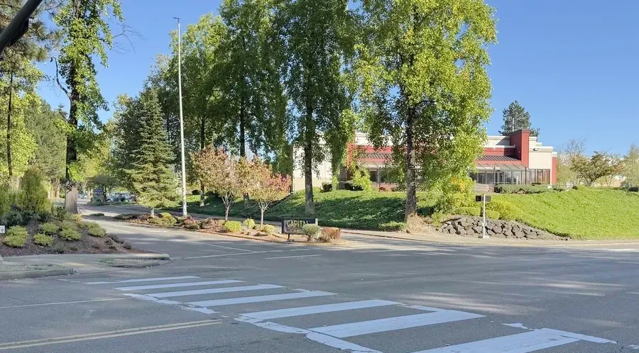
County parcel records identify Capital View around SW PLYMOUTH ST, ROGERS ST SW, DECATUR ST SW. Related record names and divisions remain separate until their original maps and governing documents establish the relationship.
Recorded construction samples:- 1918–2022 · 140 year observations · 0.19-acre median residential lot
Sampled buildings; not a complete buildout history.
Housing history, ownership & sources
- Construction history
- 1918–2022 in 140 county year-built observations; median 1989. This is a recorded-building sample, not a complete original buildout chronology.
- Residential lot sample
- 0.19 acres median across 138 residential observations. Individual lots vary; this is not a subdivision-wide minimum or maximum.
- Housing & styles
- An architectural style is not inferred from a year-built field. Confirm the actual house and original plans.
- Homebuilder
- Original builder has not been established in the sources reviewed.
- Street examples
- SW PLYMOUTH ST · ROGERS ST SW · DECATUR ST SW. Sample streets, not a boundary or a matched parcel list.
- Parcel-sample jurisdiction
- Olympia. This reflects the sampled parcels, not every property in the wider browsing region.
Recorded names & construction-year samples (1 record groups)
October 10, 2026 research snapshot. These are legal-description search groups, not a count of homes or certified plat boundaries. Divisions, phases and similarly named records remain separate. Year-built fields can include later replacement buildings and non-house property types.
Acreage is the median of positive lot-size observations below 100 acres coded RES in the research, not a measurement of every home lot. Samples can be incomplete or overlap; do not add them to calculate community totals. Confirm the actual parcel, original permit, additions and recorded map before relying on a date or size.
Evidence: parcel records. Development dates, association formation and individual home completion are separate facts. Research updated October 10, 2026.
Subdivision
A separate subdivision and association on the urban northwest edge.
Recorded construction samples:- 2005–2023 · 139 year observations · 0.14-acre median residential lot
Sampled buildings; not a complete buildout history.
Housing history, ownership & sources
- Construction history
- 2005–2023 in 139 county year-built observations; median 2006. This is a recorded-building sample, not a complete original buildout chronology.
- Residential lot sample
- 0.14 acres median across 139 residential observations. Individual lots vary; this is not a subdivision-wide minimum or maximum.
- Housing & styles
- An architectural style is not inferred from a year-built field. Confirm the actual house and original plans.
- Homebuilder
- Original builder has not been established in the sources reviewed.
- Street examples
- COOPER CREST ST NW. Sample streets, not a boundary or a matched parcel list.
- Parcel-sample jurisdiction
- Olympia. This reflects the sampled parcels, not every property in the wider browsing region.
Recorded names & construction-year samples (1 record groups)
October 10, 2026 research snapshot. These are legal-description search groups, not a count of homes or certified plat boundaries. Divisions, phases and similarly named records remain separate. Year-built fields can include later replacement buildings and non-house property types.
Acreage is the median of positive lot-size observations below 100 acres coded RES in the research, not a measurement of every home lot. Samples can be incomplete or overlap; do not add them to calculate community totals. Confirm the actual parcel, original permit, additions and recorded map before relying on a date or size.
Evidence: community documented. Development dates, association formation and individual home completion are separate facts. Research updated October 10, 2026.
Plat records
County parcel records identify Cyrene around CYRENE DR NW, ETHEL ST NW. Related record names and divisions remain separate until their original maps and governing documents establish the relationship.
Recorded construction samples:- 2014–2019 · 100 year observations · 0.11-acre median residential lot
Sampled buildings; not a complete buildout history.
Housing history, ownership & sources
- Construction history
- 2014–2019 in 100 county year-built observations; median 2016. This is a recorded-building sample, not a complete original buildout chronology.
- Residential lot sample
- 0.11 acres median across 100 residential observations. Individual lots vary; this is not a subdivision-wide minimum or maximum.
- Housing & styles
- An architectural style is not inferred from a year-built field. Confirm the actual house and original plans.
- Homebuilder
- Original builder has not been established in the sources reviewed.
- Street examples
- CYRENE DR NW · ETHEL ST NW. Sample streets, not a boundary or a matched parcel list.
- Parcel-sample jurisdiction
- Olympia. This reflects the sampled parcels, not every property in the wider browsing region.
Recorded names & construction-year samples (1 record groups)
October 10, 2026 research snapshot. These are legal-description search groups, not a count of homes or certified plat boundaries. Divisions, phases and similarly named records remain separate. Year-built fields can include later replacement buildings and non-house property types.
Acreage is the median of positive lot-size observations below 100 acres coded RES in the research, not a measurement of every home lot. Samples can be incomplete or overlap; do not add them to calculate community totals. Confirm the actual parcel, original permit, additions and recorded map before relying on a date or size.
Evidence: parcel records. Development dates, association formation and individual home completion are separate facts. Research updated October 10, 2026.
Plat records
County parcel records identify Evergreen Park around EVERGREEN PARK LN SW. Related record names and divisions remain separate until their original maps and governing documents establish the relationship.
Recorded construction samples:- 1971–1975 · 11 year observations · 0.17-acre median residential lot
Sampled buildings; not a complete buildout history.
Development history: The historical context describes Evergreen Park as a 1972–1974 planned development. This is a development chronology, not every parcel’s construction date.Source ↗
Documented builder: KOP Construction is attributed to Capitol Lake Towers specifically, not every building using the Evergreen Park name.Source ↗
Other builders may also have contributed; not all home and phase records have been reconciled.
History: The historical context describes Evergreen Park as a 1972–1974 planned development. This is a development chronology, not every parcel’s construction date.Source ↗
Housing history, ownership & sources
- Construction history
- 1971–1975 in 11 county year-built observations; median 1975. This is a recorded-building sample, not a complete original buildout chronology.
- Residential lot sample
- 0.17 acres median across 11 residential observations. Individual lots vary; this is not a subdivision-wide minimum or maximum.
- Housing & styles
- An architectural style is not inferred from a year-built field. Confirm the actual house and original plans.
- Street examples
- EVERGREEN PARK LN SW. Sample streets, not a boundary or a matched parcel list.
- Parcel-sample jurisdiction
- Olympia. This reflects the sampled parcels, not every property in the wider browsing region.
- Development history
- The historical context describes Evergreen Park as a 1972–1974 planned development. This is a development chronology, not every parcel’s construction date.Source ↗
- Architecture · documented project
- Warren Cummings Heylman & Associates is attributed to Capitol Lake Towers specifically, not every Evergreen Park home or later apartment project.Source ↗
- Homebuilder · documented offering
- KOP Construction is attributed to Capitol Lake Towers specifically, not every building using the Evergreen Park name.Source ↗
Other builders may also have contributed; not all home and phase records have been reconciled. The documented attribution applies only to the community, offering or phase identified above.
Recorded names & construction-year samples (1 record groups)
October 10, 2026 research snapshot. These are legal-description search groups, not a count of homes or certified plat boundaries. Divisions, phases and similarly named records remain separate. Year-built fields can include later replacement buildings and non-house property types.
Acreage is the median of positive lot-size observations below 100 acres coded RES in the research, not a measurement of every home lot. Samples can be incomplete or overlap; do not add them to calculate community totals. Confirm the actual parcel, original permit, additions and recorded map before relying on a date or size.
Evidence: parcel records. Development dates, association formation and individual home completion are separate facts. Research updated October 10, 2026.
Development project
A separately named residential project in Olympia’s September 2026 development report. Its dated stage is shown below; a proposal or approval does not establish completed or available housing.
Project status: September 2026 city report, entry 7; location: 1450 Evergreen Park Drive SW; reported quantities: see original report; stage: land use approval issued April 2024.Source ↗
Housing history, ownership & sources
- Construction history
- A complete construction range is not yet established; verify the house in Assessor and original permit records.
- Housing & styles
- An architectural style is not inferred from a year-built field. Confirm the actual house and original plans.
- Homebuilder
- Original builder has not been established in the sources reviewed.
- Parcel-sample jurisdiction
- Olympia. This reflects the sampled parcels, not every property in the wider browsing region.
- Project stage · dated report
- September 2026 city report, entry 7; location: 1450 Evergreen Park Drive SW; reported quantities: see original report; stage: land use approval issued April 2024.Source ↗
Evidence: planning record. Development dates, association formation and individual home completion are separate facts. Research updated October 10, 2026.
Development project
A separately named residential project in Olympia’s September 2026 development report. Its dated stage is shown below; a proposal or approval does not establish completed or available housing.
Project status: September 2026 city report, entry 8; location: 2300 Evergreen Park Dr SW; reported quantities: 199 multifamily apartment units; stage: completed July 2026.Source ↗
Housing history, ownership & sources
- Construction history
- A complete construction range is not yet established; verify the house in Assessor and original permit records.
- Housing & styles
- An architectural style is not inferred from a year-built field. Confirm the actual house and original plans.
- Homebuilder
- Original builder has not been established in the sources reviewed.
- Parcel-sample jurisdiction
- Olympia. This reflects the sampled parcels, not every property in the wider browsing region.
- Project stage · dated report
- September 2026 city report, entry 8; location: 2300 Evergreen Park Dr SW; reported quantities: 199 multifamily apartment units; stage: completed July 2026.Source ↗
Evidence: planning record. Development dates, association formation and individual home completion are separate facts. Research updated October 10, 2026.
Plat records
County parcel records identify Evergreen Pointe around HUDSON ST NW. Related record names and divisions remain separate until their original maps and governing documents establish the relationship.
Recorded construction samples:- 2012–2018 · 150 year observations · 0.12-acre median residential lot
Sampled buildings; not a complete buildout history.
Housing history, ownership & sources
- Construction history
- 2012–2018 in 150 county year-built observations; median 2016. This is a recorded-building sample, not a complete original buildout chronology.
- Residential lot sample
- 0.12 acres median across 150 residential observations. Individual lots vary; this is not a subdivision-wide minimum or maximum.
- Housing & styles
- An architectural style is not inferred from a year-built field. Confirm the actual house and original plans.
- Homebuilder
- Original builder has not been established in the sources reviewed.
- Street examples
- HUDSON ST NW. Sample streets, not a boundary or a matched parcel list.
- Parcel-sample jurisdiction
- Olympia. This reflects the sampled parcels, not every property in the wider browsing region.
Recorded names & construction-year samples (1 record groups)
October 10, 2026 research snapshot. These are legal-description search groups, not a count of homes or certified plat boundaries. Divisions, phases and similarly named records remain separate. Year-built fields can include later replacement buildings and non-house property types.
Acreage is the median of positive lot-size observations below 100 acres coded RES in the research, not a measurement of every home lot. Samples can be incomplete or overlap; do not add them to calculate community totals. Confirm the actual parcel, original permit, additions and recorded map before relying on a date or size.
Evidence: parcel records. Development dates, association formation and individual home completion are separate facts. Research updated October 10, 2026.
Development project
A separately named residential project in Olympia’s September 2026 development report. Its dated stage is shown below; a proposal or approval does not establish completed or available housing.
Project status: September 2026 city report, entry 28; location: 1111 Archwood Dr SW; reported quantities: 18 mobile home sites; stage: completed June 2026.Source ↗
Housing history, ownership & sources
- Construction history
- A complete construction range is not yet established; verify the house in Assessor and original permit records.
- Housing & styles
- An architectural style is not inferred from a year-built field. Confirm the actual house and original plans.
- Homebuilder
- Original builder has not been established in the sources reviewed.
- Parcel-sample jurisdiction
- Olympia. This reflects the sampled parcels, not every property in the wider browsing region.
- Project stage · dated report
- September 2026 city report, entry 28; location: 1111 Archwood Dr SW; reported quantities: 18 mobile home sites; stage: completed June 2026.Source ↗
Evidence: planning record. Development dates, association formation and individual home completion are separate facts. Research updated October 10, 2026.
Subdivision
The HOA describes 179 homes, greenbelts, a park and trails.
Recorded construction samples:- GOLDCREST: 1976–1990 · 14 year observations · 0.265-acre median residential lot
- GOLDCREST DIV 1: 1976–2002 · 54 year observations · 0.22-acre median residential lot
- GOLDCREST DIV 2: 1977–1989 · 16 year observations · 0.255-acre median residential lot
5 additional recorded groups in the profile. Sampled buildings; not a complete buildout history.
Shared rights & responsibilities: Confirm division, current dues and shared-maintenance obligations.
Amenities: First-party association description includes a community park, greenbelts and trails and reports 179 homes. Association home count is not the parcel count.Source ↗
Housing history, ownership & sources
- Construction history
- GOLDCREST: 1976–1990 (14 year observations); GOLDCREST DIV 1: 1976–2002 (54 year observations); GOLDCREST DIV 2: 1977–1989 (16 year observations). Additional groups appear in the table below. Separate recorded groups, not one combined buildout range.
- Housing & styles
- An architectural style is not inferred from a year-built field. Confirm the actual house and original plans.
- Homebuilder
- Original builder has not been established in the sources reviewed.
- Ownership details
- Confirm division, current dues and shared-maintenance obligations.
- Street examples
- BRIARWOOD CT NW · MEDALLION LOOP NW · MEDALLION CT NW · NW SUNNYVALE CT. Sample streets, not a boundary or a matched parcel list.
- Parcel-sample jurisdiction
- Olympia. This reflects the sampled parcels, not every property in the wider browsing region.
- Amenities & access
- First-party association description includes a community park, greenbelts and trails and reports 179 homes. Association home count is not the parcel count.Source ↗
Recorded names & construction-year samples (8 record groups)
October 10, 2026 research snapshot. These are legal-description search groups, not a count of homes or certified plat boundaries. Divisions, phases and similarly named records remain separate. Year-built fields can include later replacement buildings and non-house property types.
Acreage is the median of positive lot-size observations below 100 acres coded RES in the research, not a measurement of every home lot. Samples can be incomplete or overlap; do not add them to calculate community totals. Confirm the actual parcel, original permit, additions and recorded map before relying on a date or size.
Evidence: community documented. Development dates, association formation and individual home completion are separate facts. Research updated October 10, 2026.
Plat records
County parcel records identify Grass Lake Village around YAUGER WAY NW. Related record names and divisions remain separate until their original maps and governing documents establish the relationship.
Recorded construction samples:- GRASS LAKE VILLAGE DIV 1: 2002–2016 · 39 year observations · 0.08-acre median residential lot
- GRASS LAKE VILLAGE DIV 2: 2003–2017 · 48 year observations · 0.09-acre median residential lot
- GRASS LAKE VILLAGE DIV 3: 2005–2007 · 47 year observations · 0.09-acre median residential lot
Sampled buildings; not a complete buildout history.
Housing history, ownership & sources
- Construction history
- GRASS LAKE VILLAGE DIV 1: 2002–2016 (39 year observations); GRASS LAKE VILLAGE DIV 2: 2003–2017 (48 year observations); GRASS LAKE VILLAGE DIV 3: 2005–2007 (47 year observations). Separate recorded groups, not one combined buildout range.
- Housing & styles
- An architectural style is not inferred from a year-built field. Confirm the actual house and original plans.
- Homebuilder
- Original builder has not been established in the sources reviewed.
- Street examples
- YAUGER WAY NW. Sample streets, not a boundary or a matched parcel list.
- Parcel-sample jurisdiction
- Olympia. This reflects the sampled parcels, not every property in the wider browsing region.
Recorded names & construction-year samples (3 record groups)
October 10, 2026 research snapshot. These are legal-description search groups, not a count of homes or certified plat boundaries. Divisions, phases and similarly named records remain separate. Year-built fields can include later replacement buildings and non-house property types.
Acreage is the median of positive lot-size observations below 100 acres coded RES in the research, not a measurement of every home lot. Samples can be incomplete or overlap; do not add them to calculate community totals. Confirm the actual parcel, original permit, additions and recorded map before relying on a date or size.
Evidence: parcel records. Development dates, association formation and individual home completion are separate facts. Research updated October 10, 2026.
Development project
A separately named residential project in Olympia’s September 2026 development report. Its dated stage is shown below; a proposal or approval does not establish completed or available housing.
Project status: September 2026 city report, entry 27; location: 2200 Cooper Point Rd NW; reported quantities: 177 residential lots; stage: project will be decided by the Hearing Examiner.Source ↗
Housing history, ownership & sources
- Construction history
- A complete construction range is not yet established; verify the house in Assessor and original permit records.
- Housing & styles
- An architectural style is not inferred from a year-built field. Confirm the actual house and original plans.
- Homebuilder
- Original builder has not been established in the sources reviewed.
- Parcel-sample jurisdiction
- Olympia. This reflects the sampled parcels, not every property in the wider browsing region.
- Project stage · dated report
- September 2026 city report, entry 27; location: 2200 Cooper Point Rd NW; reported quantities: 177 residential lots; stage: project will be decided by the Hearing Examiner.Source ↗
Evidence: planning record. Development dates, association formation and individual home completion are separate facts. Research updated October 10, 2026.
Development project
A separately named residential project in Olympia’s September 2026 development report. Its dated stage is shown below; a proposal or approval does not establish completed or available housing.
Project status: September 2026 city report, entry 12; location: 3909 9th Ave SW; reported quantities: 272 dwelling units; stage: under construction.Source ↗
Housing history, ownership & sources
- Construction history
- A complete construction range is not yet established; verify the house in Assessor and original permit records.
- Housing & styles
- An architectural style is not inferred from a year-built field. Confirm the actual house and original plans.
- Homebuilder
- Original builder has not been established in the sources reviewed.
- Parcel-sample jurisdiction
- Olympia. This reflects the sampled parcels, not every property in the wider browsing region.
- Project stage · dated report
- September 2026 city report, entry 12; location: 3909 9th Ave SW; reported quantities: 272 dwelling units; stage: under construction.Source ↗
Evidence: planning record. Development dates, association formation and individual home completion are separate facts. Research updated October 10, 2026.
Development project
A separately named residential project in Olympia’s September 2026 development report. Its dated stage is shown below; a proposal or approval does not establish completed or available housing.
Project status: September 2026 city report, entry 13; location: 2309 Harrison Avenue NW; reported quantities: see original report; stage: engineering and building permits ready for issuance.Source ↗
Housing history, ownership & sources
- Construction history
- A complete construction range is not yet established; verify the house in Assessor and original permit records.
- Housing & styles
- An architectural style is not inferred from a year-built field. Confirm the actual house and original plans.
- Homebuilder
- Original builder has not been established in the sources reviewed.
- Parcel-sample jurisdiction
- Olympia. This reflects the sampled parcels, not every property in the wider browsing region.
- Project stage · dated report
- September 2026 city report, entry 13; location: 2309 Harrison Avenue NW; reported quantities: see original report; stage: engineering and building permits ready for issuance.Source ↗
Evidence: planning record. Development dates, association formation and individual home completion are separate facts. Research updated October 10, 2026.
Subdivision
Kaiser Place is a compact West Olympia subdivision around 6th Avenue NW and Chamfer Drive NW, with an early-2000s detached-home sample and Grass Lake Nature Park in the surrounding area.
Construction context: County residential sample: 40 year-built values, 2003–2005, median 2004. This is assessor context, not a certified buildout history.
Documented builder(s): Not established in the primary sources reviewed. Original permits and lot-specific construction records are needed before attributing a builder.
Other builders may also have contributed; not all home and phase records have been reconciled.
Housing detail: Detached-home subdivision; the 40 residential lots sampled have a 0.11-acre median. Individual size, layout and usable yard vary.
Shared rights & responsibilities: Recognized homeowners association. Verify the home’s membership, current dues, budget, reserves, insurance, rules and shared-maintenance obligations from current documents.
Housing history, ownership & sources
- Construction history
- County residential sample: 40 year-built values, 2003–2005, median 2004. This is assessor context, not a certified buildout history.
- Residential lot sample
- 0.11 acres median across 40 residential observations. Individual lots vary; this is not a subdivision-wide minimum or maximum.
- Housing & styles
- Detached-home subdivision; the 40 residential lots sampled have a 0.11-acre median. Individual size, layout and usable yard vary.
- Homebuilder
- Not established in the primary sources reviewed. Original permits and lot-specific construction records are needed before attributing a builder.
- Ownership details
- Recognized homeowners association. Verify the home’s membership, current dues, budget, reserves, insurance, rules and shared-maintenance obligations from current documents.
- Location & setting
- The KAISER PLACE plat sample identifies 6th Avenue NW and Chamfer Drive NW. Keep this subdivision separate from the wider Kaiser Road corridor, Kaiser Woods and newer communities using nearby road names.
- Street examples
- 6th Avenue NW · Chamfer Drive NW. Sample streets, not a boundary or a matched parcel list.
Other builders may also have contributed; not all home and phase records have been reconciled. The documented attribution applies only to the community, offering or phase identified above.
Recorded names & construction-year samples (1 record groups)
October 10, 2026 research snapshot. These are legal-description search groups, not a count of homes or certified plat boundaries. Divisions, phases and similarly named records remain separate. Year-built fields can include later replacement buildings and non-house property types.
Acreage is the median of positive lot-size observations below 100 acres coded RES in the research, not a measurement of every home lot. Samples can be incomplete or overlap; do not add them to calculate community totals. Confirm the actual parcel, original permit, additions and recorded map before relying on a date or size.
Evidence: community documented. Development dates, association formation and individual home completion are separate facts. Research updated October 10, 2026.
Subdivision
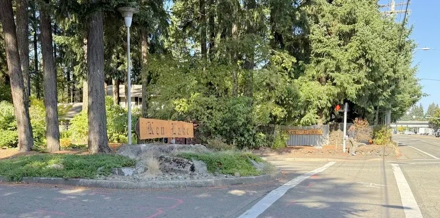
A residential community around a private lake, searchable under both names.
Construction context: Residential development in the 1960s; verify each improvement year.
Developer: Richard Swanson and Jim Whisler
Shared rights & responsibilities: Lake and amenity rights depend on the recorded community relationship.
Amenities: Association identifies its private natural Ken Lake and community recreation. Ken Lake/Lakemoor search linkage is documented; individual recorded divisions remain separate.Source ↗
Housing history, ownership & sources
- Construction history
- Residential development in the 1960s; verify each improvement year.
- Housing & styles
- An architectural style is not inferred from a year-built field. Confirm the actual house and original plans.
- Developer
- Richard Swanson and Jim Whisler
- Homebuilder
- Original builder has not been established in the sources reviewed.
- Ownership details
- Lake and amenity rights depend on the recorded community relationship.
- Street examples
- CAMDEN PARK DR SW · CEDARBURY LN SW · CANTERBURY PL SW · LAKEMOOR PL SW. Sample streets, not a boundary or a matched parcel list.
- Developer
- Richard Swanson and Jim Whisler developed Ken Lake during the 1960s. Lakemoor is the community identity used by its association.Source ↗
- Amenities & access
- Association identifies its private natural Ken Lake and community recreation. Ken Lake/Lakemoor search linkage is documented; individual recorded divisions remain separate.Source ↗
Recorded names & construction-year samples (7 record groups)
October 10, 2026 research snapshot. These are legal-description search groups, not a count of homes or certified plat boundaries. Divisions, phases and similarly named records remain separate. Year-built fields can include later replacement buildings and non-house property types.
Acreage is the median of positive lot-size observations below 100 acres coded RES in the research, not a measurement of every home lot. Samples can be incomplete or overlap; do not add them to calculate community totals. Confirm the actual parcel, original permit, additions and recorded map before relying on a date or size.
Evidence: history documented. Development dates, association formation and individual home completion are separate facts. Research updated October 10, 2026.
Neighborhood
The established association area above West Bay.
Housing history, ownership & sources
- Construction history
- A complete construction range is not yet established; verify the house in Assessor and original permit records.
- Housing & styles
- An architectural style is not inferred from a year-built field. Confirm the actual house and original plans.
- Homebuilder
- Original builder has not been established in the sources reviewed.
Evidence: community documented. Development dates, association formation and individual home completion are separate facts.
Subdivision
The city-sponsored history places this 1945 plat on the Westside, near Fourth Avenue and Decatur. Nortons Addition is retained as a separate recorded-name search until the original map confirms the relationship.
Construction context: Platted in 1945; individual home construction and alterations vary.
Development history: Historical context dates the Norton Plat to 1945 on Olympia’s Westside. The Eastside website assignment conflicts with that evidence; Norton/Nortons legal-name variants still need image reconciliation.Source ↗
History: Historical context dates the Norton Plat to 1945 on Olympia’s Westside. The Eastside website assignment conflicts with that evidence; Norton/Nortons legal-name variants still need image reconciliation.Source ↗
Housing history, ownership & sources
- Construction history
- Platted in 1945; individual home construction and alterations vary.
- Housing & styles
- An architectural style is not inferred from a year-built field. Confirm the actual house and original plans.
- Homebuilder
- Original builder has not been established in the sources reviewed.
- Development history
- Historical context dates the Norton Plat to 1945 on Olympia’s Westside. The Eastside website assignment conflicts with that evidence; Norton/Nortons legal-name variants still need image reconciliation.Source ↗
Evidence: history documented. Development dates, association formation and individual home completion are separate facts. Research updated October 10, 2026.
Plat records
County parcel records identify Nortons Addition · recorded name around W 4TH AVE, SW 5TH AVE, SW 7TH AVE. Related record names and divisions remain separate until their original maps and governing documents establish the relationship.
Recorded construction samples:- 1946–2016 · 33 year observations · 0.16-acre median residential lot
Sampled buildings; not a complete buildout history.
Housing history, ownership & sources
- Construction history
- 1946–2016 in 33 county year-built observations; median 1950. This is a recorded-building sample, not a complete original buildout chronology.
- Residential lot sample
- 0.16 acres median across 33 residential observations. Individual lots vary; this is not a subdivision-wide minimum or maximum.
- Housing & styles
- An architectural style is not inferred from a year-built field. Confirm the actual house and original plans.
- Homebuilder
- Original builder has not been established in the sources reviewed.
- Street examples
- W 4TH AVE · SW 5TH AVE · SW 7TH AVE. Sample streets, not a boundary or a matched parcel list.
- Parcel-sample jurisdiction
- Olympia. This reflects the sampled parcels, not every property in the wider browsing region.
Recorded names & construction-year samples (1 record groups)
October 10, 2026 research snapshot. These are legal-description search groups, not a count of homes or certified plat boundaries. Divisions, phases and similarly named records remain separate. Year-built fields can include later replacement buildings and non-house property types.
Acreage is the median of positive lot-size observations below 100 acres coded RES in the research, not a measurement of every home lot. Samples can be incomplete or overlap; do not add them to calculate community totals. Confirm the actual parcel, original permit, additions and recorded map before relying on a date or size.
Evidence: parcel records. Development dates, association formation and individual home completion are separate facts. Research updated October 10, 2026.
Subdivision
A newer KB Home community on Sunbeam Street NW.
Construction context: Grand opening September 2025; completion dates vary by lot.
Documented builder(s): KB Home
Other builders may also have contributed; not all home and phase records have been reconciled.
Housing detail: New production homes; plan and phase specifications vary.
Project status: September 2026 city report, entry 31; location: 4840 Harrison Avenue NW; reported quantities: 70 single-family lots; stage: homes under construction.Source ↗
Housing history, ownership & sources
- Construction history
- Grand opening September 2025; completion dates vary by lot.
- Residential lot sample
- 0.11 acres median across 30 residential observations. Individual lots vary; this is not a subdivision-wide minimum or maximum.
- Housing & styles
- New production homes; plan and phase specifications vary.
- Homebuilder
- KB Home
- Street examples
- SUNBEAM ST NW · SERENE VIEW PL NW. Sample streets, not a boundary or a matched parcel list.
- Parcel-sample jurisdiction
- Olympia · Unincorporated Thurston County. This reflects the sampled parcels, not every property in the wider browsing region.
- Project stage · dated report
- September 2026 city report, entry 31; location: 4840 Harrison Avenue NW; reported quantities: 70 single-family lots; stage: homes under construction.Source ↗
- Homebuilder · documented offering
- KB Home announced the Olympia community opening September 26, 2025.Source ↗
Other builders may also have contributed; not all home and phase records have been reconciled. The documented attribution applies only to the community, offering or phase identified above.
Recorded names & construction-year samples (1 record groups)
October 10, 2026 research snapshot. These are legal-description search groups, not a count of homes or certified plat boundaries. Divisions, phases and similarly named records remain separate. Year-built fields can include later replacement buildings and non-house property types.
Acreage is the median of positive lot-size observations below 100 acres coded RES in the research, not a measurement of every home lot. Samples can be incomplete or overlap; do not add them to calculate community totals. Confirm the actual parcel, original permit, additions and recorded map before relying on a date or size.
Evidence: community documented. Development dates, association formation and individual home completion are separate facts. Research updated October 10, 2026.
Development project
A separately named residential project in Olympia’s September 2026 development report. Its dated stage is shown below; a proposal or approval does not establish completed or available housing.
Project status: September 2026 city report, entry 18; location: 1525 Palomino Dr SE; reported quantities: 34 multifamily units; stage: under land use and design review.Source ↗
Housing history, ownership & sources
- Construction history
- A complete construction range is not yet established; verify the house in Assessor and original permit records.
- Housing & styles
- An architectural style is not inferred from a year-built field. Confirm the actual house and original plans.
- Homebuilder
- Original builder has not been established in the sources reviewed.
- Parcel-sample jurisdiction
- Olympia. This reflects the sampled parcels, not every property in the wider browsing region.
- Project stage · dated report
- September 2026 city report, entry 18; location: 1525 Palomino Dr SE; reported quantities: 34 multifamily units; stage: under land use and design review.Source ↗
Evidence: planning record. Development dates, association formation and individual home completion are separate facts. Research updated October 10, 2026.
Plat records
County parcel records identify Second Railroad Addition To Olympia around NW ROGERS ST, ROGERS ST NW, MILROY ST NW. Related record names and divisions remain separate until their original maps and governing documents establish the relationship.
Recorded construction samples:- 1890–2020 · 94 year observations · 0.14-acre median residential lot
Sampled buildings; not a complete buildout history.
Housing history, ownership & sources
- Construction history
- 1890–2020 in 94 county year-built observations; median 1957. This is a recorded-building sample, not a complete original buildout chronology.
- Residential lot sample
- 0.14 acres median across 90 residential observations. Individual lots vary; this is not a subdivision-wide minimum or maximum.
- Housing & styles
- An architectural style is not inferred from a year-built field. Confirm the actual house and original plans.
- Homebuilder
- Original builder has not been established in the sources reviewed.
- Street examples
- NW ROGERS ST · ROGERS ST NW · MILROY ST NW. Sample streets, not a boundary or a matched parcel list.
- Parcel-sample jurisdiction
- Olympia. This reflects the sampled parcels, not every property in the wider browsing region.
Recorded names & construction-year samples (1 record groups)
October 10, 2026 research snapshot. These are legal-description search groups, not a count of homes or certified plat boundaries. Divisions, phases and similarly named records remain separate. Year-built fields can include later replacement buildings and non-house property types.
Acreage is the median of positive lot-size observations below 100 acres coded RES in the research, not a measurement of every home lot. Samples can be incomplete or overlap; do not add them to calculate community totals. Confirm the actual parcel, original permit, additions and recorded map before relying on a date or size.
Evidence: parcel records. Development dates, association formation and individual home completion are separate facts. Research updated October 10, 2026.
Neighborhood
The Southwest association area has its own streets and local routes.
Housing history, ownership & sources
- Construction history
- A complete construction range is not yet established; verify the house in Assessor and original permit records.
- Housing & styles
- An architectural style is not inferred from a year-built field. Confirm the actual house and original plans.
- Homebuilder
- Original builder has not been established in the sources reviewed.
Evidence: community documented. Development dates, association formation and individual home completion are separate facts.
Development project
A separately named residential project in Olympia’s September 2026 development report. Its dated stage is shown below; a proposal or approval does not establish completed or available housing.
Project status: September 2026 city report, entry 35; location: northwest of Allen Road gate; reported quantities: 22 residential lots; stage: project will be decided by the Hearing Examiner.Source ↗
Housing history, ownership & sources
- Construction history
- A complete construction range is not yet established; verify the house in Assessor and original permit records.
- Housing & styles
- An architectural style is not inferred from a year-built field. Confirm the actual house and original plans.
- Homebuilder
- Original builder has not been established in the sources reviewed.
- Parcel-sample jurisdiction
- Olympia. This reflects the sampled parcels, not every property in the wider browsing region.
- Project stage · dated report
- September 2026 city report, entry 35; location: northwest of Allen Road gate; reported quantities: 22 residential lots; stage: project will be decided by the Hearing Examiner.Source ↗
Evidence: planning record. Development dates, association formation and individual home completion are separate facts. Research updated October 10, 2026.
Development project
A separately named residential project in Olympia’s September 2026 development report. Its dated stage is shown below; a proposal or approval does not establish completed or available housing.
Project status: September 2026 city report, entry 33; location: 2210 Walnut Road NW; reported quantities: 21 lots; stage: project will be decided by the Hearing Examiner.Source ↗
Housing history, ownership & sources
- Construction history
- A complete construction range is not yet established; verify the house in Assessor and original permit records.
- Housing & styles
- An architectural style is not inferred from a year-built field. Confirm the actual house and original plans.
- Homebuilder
- Original builder has not been established in the sources reviewed.
- Parcel-sample jurisdiction
- Olympia. This reflects the sampled parcels, not every property in the wider browsing region.
- Project stage · dated report
- September 2026 city report, entry 33; location: 2210 Walnut Road NW; reported quantities: 21 lots; stage: project will be decided by the Hearing Examiner.Source ↗
Evidence: planning record. Development dates, association formation and individual home completion are separate facts. Research updated October 10, 2026.
Subdivision
Walnut Park is an established West Olympia subdivision on Walnut Loop NW, with a late-1980s to early-1990s housing sample and its own recognized homeowners association.
Construction context: County residential sample: 54 year-built values, 1988–1992, median 1989. This is assessor context, not a certified buildout history.
Documented builder(s): Not established in the primary sources reviewed. Original permits and lot-specific construction records are needed before attributing a builder.
Other builders may also have contributed; not all home and phase records have been reconciled.
Housing detail: Detached-home subdivision; the 54 residential lots sampled have a 0.23-acre median. Individual size, layout and usable yard vary.
Shared rights & responsibilities: Recognized homeowners association. Verify the home’s membership, current dues, budget, reserves, insurance, rules and shared-maintenance obligations from current documents.
Housing history, ownership & sources
- Construction history
- County residential sample: 54 year-built values, 1988–1992, median 1989. This is assessor context, not a certified buildout history.
- Residential lot sample
- 0.23 acres median across 54 residential observations. Individual lots vary; this is not a subdivision-wide minimum or maximum.
- Housing & styles
- Detached-home subdivision; the 54 residential lots sampled have a 0.23-acre median. Individual size, layout and usable yard vary.
- Homebuilder
- Not established in the primary sources reviewed. Original permits and lot-specific construction records are needed before attributing a builder.
- Ownership details
- Recognized homeowners association. Verify the home’s membership, current dues, budget, reserves, insurance, rules and shared-maintenance obligations from current documents.
- Location & setting
- The WALNUT PARK plat sample centers on Walnut Loop NW. It is distinct from Walnut Grove and from any nearby wooded parcel informally described as a park.
- Street examples
- Walnut Loop NW. Sample streets, not a boundary or a matched parcel list.
Other builders may also have contributed; not all home and phase records have been reconciled. The documented attribution applies only to the community, offering or phase identified above.
Recorded names & construction-year samples (1 record groups)
October 10, 2026 research snapshot. These are legal-description search groups, not a count of homes or certified plat boundaries. Divisions, phases and similarly named records remain separate. Year-built fields can include later replacement buildings and non-house property types.
Acreage is the median of positive lot-size observations below 100 acres coded RES in the research, not a measurement of every home lot. Samples can be incomplete or overlap; do not add them to calculate community totals. Confirm the actual parcel, original permit, additions and recorded map before relying on a date or size.
Evidence: community documented. Development dates, association formation and individual home completion are separate facts. Research updated October 10, 2026.
Development project
A separately named residential project in Olympia’s September 2026 development report. Its dated stage is shown below; a proposal or approval does not establish completed or available housing.
Project status: September 2026 city report, entry 37; location: southwest corner of Walnut Rd and Ethel St; reported quantities: 21 residential lots; stage: project will be decided by the Hearing Examiner.Source ↗
Housing history, ownership & sources
- Construction history
- A complete construction range is not yet established; verify the house in Assessor and original permit records.
- Housing & styles
- An architectural style is not inferred from a year-built field. Confirm the actual house and original plans.
- Homebuilder
- Original builder has not been established in the sources reviewed.
- Parcel-sample jurisdiction
- Olympia. This reflects the sampled parcels, not every property in the wider browsing region.
- Project stage · dated report
- September 2026 city report, entry 37; location: southwest corner of Walnut Rd and Ethel St; reported quantities: 21 residential lots; stage: project will be decided by the Hearing Examiner.Source ↗
Evidence: planning record. Development dates, association formation and individual home completion are separate facts. Research updated October 10, 2026.
Subdivision
A distinct community with separately identified phases.
Recorded construction samples:- WELLINGTON WEST: 1998–2002 · 2 year observations · 0.23-acre median residential lot
- WELLINGTON WEST DIV 1: 1997–2000 · 37 year observations · 0.21-acre median residential lot
- WELLINGTON WEST DIV 2: 1999–2000 · 23 year observations · 0.15-acre median residential lot
2 additional recorded groups in the profile. Sampled buildings; not a complete buildout history.
Housing history, ownership & sources
- Construction history
- WELLINGTON WEST: 1998–2002 (2 year observations); WELLINGTON WEST DIV 1: 1997–2000 (37 year observations); WELLINGTON WEST DIV 2: 1999–2000 (23 year observations). Additional groups appear in the table below. Separate recorded groups, not one combined buildout range.
- Housing & styles
- An architectural style is not inferred from a year-built field. Confirm the actual house and original plans.
- Homebuilder
- Original builder has not been established in the sources reviewed.
- Street examples
- FERN ST SW · DIVISION ST SW · CUSHING ST SW. Sample streets, not a boundary or a matched parcel list.
- Parcel-sample jurisdiction
- Olympia. This reflects the sampled parcels, not every property in the wider browsing region.
Recorded names & construction-year samples (5 record groups)
October 10, 2026 research snapshot. These are legal-description search groups, not a count of homes or certified plat boundaries. Divisions, phases and similarly named records remain separate. Year-built fields can include later replacement buildings and non-house property types.
Acreage is the median of positive lot-size observations below 100 acres coded RES in the research, not a measurement of every home lot. Samples can be incomplete or overlap; do not add them to calculate community totals. Confirm the actual parcel, original permit, additions and recorded map before relying on a date or size.
Evidence: community documented. Development dates, association formation and individual home completion are separate facts. Research updated October 10, 2026.
Neighborhood
The waterfront road and hillside association area is distinct from the inland grid.
Housing history, ownership & sources
- Construction history
- A complete construction range is not yet established; verify the house in Assessor and original permit records.
- Housing & styles
- An architectural style is not inferred from a year-built field. Confirm the actual house and original plans.
- Homebuilder
- Original builder has not been established in the sources reviewed.
Evidence: community documented. Development dates, association formation and individual home completion are separate facts.
Subdivision
A separately documented postwar development in the West Bay hillside setting.
Construction context: Development dated to 1957; check each house.
Development history: Historical context dates West Bay Hills to 1957; no blanket builder attribution is established.Source ↗
History: Historical context dates West Bay Hills to 1957; no blanket builder attribution is established.Source ↗
Housing history, ownership & sources
- Construction history
- Development dated to 1957; check each house.
- Residential lot sample
- 0.21 acres median across 19 residential observations. Individual lots vary; this is not a subdivision-wide minimum or maximum.
- Housing & styles
- An architectural style is not inferred from a year-built field. Confirm the actual house and original plans.
- Homebuilder
- Original builder has not been established in the sources reviewed.
- Street examples
- RAFT AVE NW · EBB TIDE TER NW · SKYLINE TER NW. Sample streets, not a boundary or a matched parcel list.
- Parcel-sample jurisdiction
- Olympia. This reflects the sampled parcels, not every property in the wider browsing region.
- Development history
- Historical context dates West Bay Hills to 1957; no blanket builder attribution is established.Source ↗
Recorded names & construction-year samples (1 record groups)
October 10, 2026 research snapshot. These are legal-description search groups, not a count of homes or certified plat boundaries. Divisions, phases and similarly named records remain separate. Year-built fields can include later replacement buildings and non-house property types.
Acreage is the median of positive lot-size observations below 100 acres coded RES in the research, not a measurement of every home lot. Samples can be incomplete or overlap; do not add them to calculate community totals. Confirm the actual parcel, original permit, additions and recorded map before relying on a date or size.
Evidence: history documented. Development dates, association formation and individual home completion are separate facts. Research updated October 10, 2026.
Development project
A separately named residential project in Olympia’s September 2026 development report. Its dated stage is shown below; a proposal or approval does not establish completed or available housing.
Project status: September 2026 city report, entry 21; location: 1210 West Bay Drive NW; reported quantities: 478 multifamily residential units; stage: land use approval issued by the Hearing Examiner and Department of Ecology September 2026.Source ↗
Housing history, ownership & sources
- Construction history
- A complete construction range is not yet established; verify the house in Assessor and original permit records.
- Housing & styles
- An architectural style is not inferred from a year-built field. Confirm the actual house and original plans.
- Homebuilder
- Original builder has not been established in the sources reviewed.
- Parcel-sample jurisdiction
- Olympia. This reflects the sampled parcels, not every property in the wider browsing region.
- Project stage · dated report
- September 2026 city report, entry 21; location: 1210 West Bay Drive NW; reported quantities: 478 multifamily residential units; stage: land use approval issued by the Hearing Examiner and Department of Ecology September 2026.Source ↗
Evidence: planning record. Development dates, association formation and individual home completion are separate facts. Research updated October 10, 2026.
Development project
A separately named residential project in Olympia’s September 2026 development report. Its dated stage is shown below; a proposal or approval does not establish completed or available housing.
Project status: September 2026 city report, entry 22; location: 2000 West Bay Dr NW; reported quantities: 242 residential units; stage: project will be decided by the Hearing Examiner.Source ↗
Housing history, ownership & sources
- Construction history
- A complete construction range is not yet established; verify the house in Assessor and original permit records.
- Housing & styles
- An architectural style is not inferred from a year-built field. Confirm the actual house and original plans.
- Homebuilder
- Original builder has not been established in the sources reviewed.
- Parcel-sample jurisdiction
- Olympia. This reflects the sampled parcels, not every property in the wider browsing region.
- Project stage · dated report
- September 2026 city report, entry 22; location: 2000 West Bay Dr NW; reported quantities: 242 residential units; stage: project will be decided by the Hearing Examiner.Source ↗
Evidence: planning record. Development dates, association formation and individual home completion are separate facts. Research updated October 10, 2026.
Plat records
County parcel records identify West Olympia · plat records around NW 25TH AVE. Related record names and divisions remain separate until their original maps and governing documents establish the relationship.
Recorded construction samples:- 1880–2025 · 87 year observations · 0.44-acre median residential lot
Sampled buildings; not a complete buildout history.
Housing history, ownership & sources
- Construction history
- 1880–2025 in 87 county year-built observations; median 1979. This is a recorded-building sample, not a complete original buildout chronology.
- Residential lot sample
- 0.44 acres median across 89 residential observations. Individual lots vary; this is not a subdivision-wide minimum or maximum.
- Housing & styles
- An architectural style is not inferred from a year-built field. Confirm the actual house and original plans.
- Homebuilder
- Original builder has not been established in the sources reviewed.
- Street examples
- NW 25TH AVE. Sample streets, not a boundary or a matched parcel list.
- Parcel-sample jurisdiction
- Unincorporated Thurston County. This reflects the sampled parcels, not every property in the wider browsing region.
Recorded names & construction-year samples (1 record groups)
October 10, 2026 research snapshot. These are legal-description search groups, not a count of homes or certified plat boundaries. Divisions, phases and similarly named records remain separate. Year-built fields can include later replacement buildings and non-house property types.
Acreage is the median of positive lot-size observations below 100 acres coded RES in the research, not a measurement of every home lot. Samples can be incomplete or overlap; do not add them to calculate community totals. Confirm the actual parcel, original permit, additions and recorded map before relying on a date or size.
Evidence: parcel records. Development dates, association formation and individual home completion are separate facts. Research updated October 10, 2026.
Plat records
County parcel records identify Woodbury Crossing around GREENWOOD DR SW, SANDALWOOD DR SW, MEADOWWOOD DR SW, BIRCHWOOD DR SW. Related record names and divisions remain separate until their original maps and governing documents establish the relationship.
Recorded construction samples:- WOODBURY CROSSING: 2009–2016 · 105 year observations · 0.1-acre median residential lot
- WOODBURY CROSSING PH 2: 2014–2017 · 64 year observations · 0.1-acre median residential lot
- WOODBURY CROSSING PH 3: 2016–2018 · 74 year observations · 0.08-acre median residential lot
Sampled buildings; not a complete buildout history.
Documented builder: RM Homes announced a ten-home Woodbury Crossing offering in May 2014. This attribution is limited to that documented offering, not the entire subdivision.Source ↗
Documented builder: Lennar announced the Woodbury Crossing II grand opening for May 31, 2014, not 2016. Marketing II is not automatically identical to every county Phase 2 parcel.Source ↗
Other builders may also have contributed; not all home and phase records have been reconciled.
Housing history, ownership & sources
- Construction history
- WOODBURY CROSSING: 2009–2016 (105 year observations); WOODBURY CROSSING PH 2: 2014–2017 (64 year observations); WOODBURY CROSSING PH 3: 2016–2018 (74 year observations). Separate recorded groups, not one combined buildout range.
- Street examples
- GREENWOOD DR SW · SANDALWOOD DR SW · MEADOWWOOD DR SW · BIRCHWOOD DR SW. Sample streets, not a boundary or a matched parcel list.
- Parcel-sample jurisdiction
- Olympia. This reflects the sampled parcels, not every property in the wider browsing region.
- Homebuilder · documented offering
- RM Homes announced a ten-home Woodbury Crossing offering in May 2014. This attribution is limited to that documented offering, not the entire subdivision.Source ↗
- Homebuilder · documented offering
- Lennar announced the Woodbury Crossing II grand opening for May 31, 2014, not 2016. Marketing II is not automatically identical to every county Phase 2 parcel.Source ↗
- Housing & plans · documented offering
- The 2014 Lennar offering described two-story plans of 1,836–2,501 square feet. These historical plans do not establish every house’s style or present size.Source ↗
Other builders may also have contributed; not all home and phase records have been reconciled. The documented attribution applies only to the community, offering or phase identified above.
Recorded names & construction-year samples (3 record groups)
October 10, 2026 research snapshot. These are legal-description search groups, not a count of homes or certified plat boundaries. Divisions, phases and similarly named records remain separate. Year-built fields can include later replacement buildings and non-house property types.
Acreage is the median of positive lot-size observations below 100 acres coded RES in the research, not a measurement of every home lot. Samples can be incomplete or overlap; do not add them to calculate community totals. Confirm the actual parcel, original permit, additions and recorded map before relying on a date or size.
Evidence: parcel records. Development dates, association formation and individual home completion are separate facts. Research updated October 10, 2026.
Plat records
County parcel records identify Woodruff Addition To Olympia around MILROY ST NW, SHERMAN ST NW, DECATUR ST NW. Related record names and divisions remain separate until their original maps and governing documents establish the relationship.
Recorded construction samples:- 1880–2025 · 181 year observations · 0.13-acre median residential lot
Sampled buildings; not a complete buildout history.
Housing history, ownership & sources
- Construction history
- 1880–2025 in 181 county year-built observations; median 1939. This is a recorded-building sample, not a complete original buildout chronology.
- Residential lot sample
- 0.13 acres median across 165 residential observations. Individual lots vary; this is not a subdivision-wide minimum or maximum.
- Housing & styles
- An architectural style is not inferred from a year-built field. Confirm the actual house and original plans.
- Homebuilder
- Original builder has not been established in the sources reviewed.
- Street examples
- MILROY ST NW · SHERMAN ST NW · DECATUR ST NW. Sample streets, not a boundary or a matched parcel list.
- Parcel-sample jurisdiction
- Olympia. This reflects the sampled parcels, not every property in the wider browsing region.
Recorded names & construction-year samples (1 record groups)
October 10, 2026 research snapshot. These are legal-description search groups, not a count of homes or certified plat boundaries. Divisions, phases and similarly named records remain separate. Year-built fields can include later replacement buildings and non-house property types.
Acreage is the median of positive lot-size observations below 100 acres coded RES in the research, not a measurement of every home lot. Samples can be incomplete or overlap; do not add them to calculate community totals. Confirm the actual parcel, original permit, additions and recorded map before relying on a date or size.
Evidence: parcel records. Development dates, association formation and individual home completion are separate facts. Research updated October 10, 2026.
Subdivision
A separately named place documented by the linked historical or community sources. The record does not identify every house or establish a complete legal boundary.
Development history: Historical context lists the Yantis Raft Plat in 1950. Recorded boundaries and individual builders remain unresolved.Source ↗
History: Historical context lists the Yantis Raft Plat in 1950. Recorded boundaries and individual builders remain unresolved.Source ↗
Housing history, ownership & sources
- Construction history
- A complete construction range is not yet established; verify the house in Assessor and original permit records.
- Housing & styles
- An architectural style is not inferred from a year-built field. Confirm the actual house and original plans.
- Homebuilder
- Original builder has not been established in the sources reviewed.
- Development history
- Historical context lists the Yantis Raft Plat in 1950. Recorded boundaries and individual builders remain unresolved.Source ↗
Evidence: history documented. Development dates, association formation and individual home completion are separate facts. Research updated October 10, 2026.
A named place is included even when photographs or a complete builder history are still being gathered. Exact home facts belong to its parcel, plat, permits and current association documents.