
Parks & local places
Waterfront landscape. Check the route and public access from the home you’re considering.
A local guide to everyday life
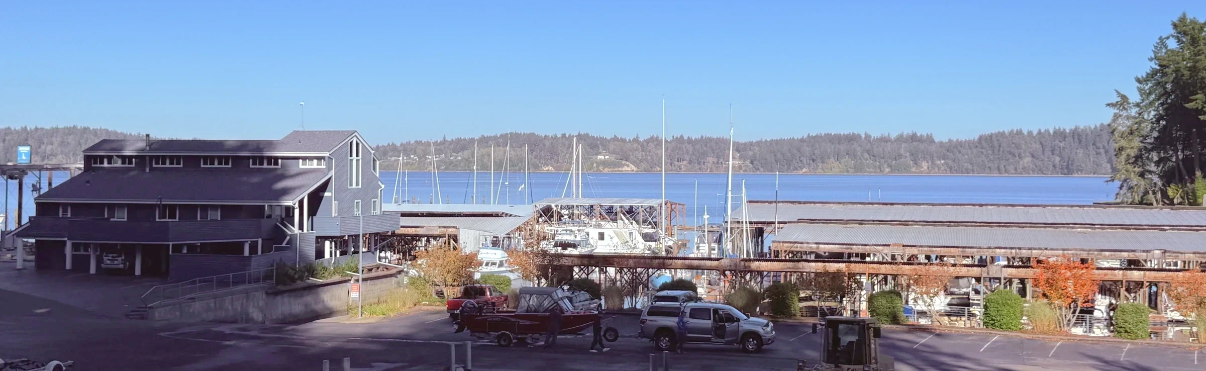
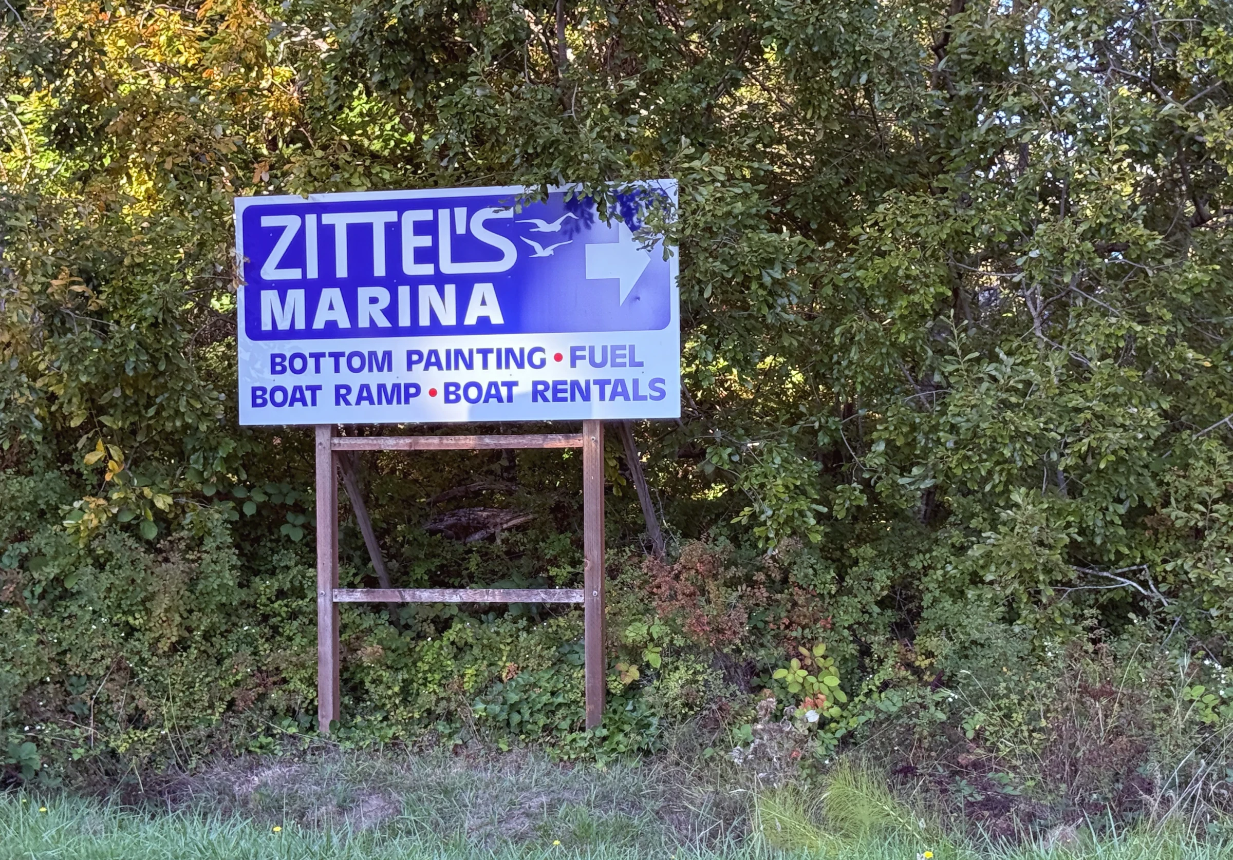
A north Thurston County waterfront destination with a wooded approach and working marina at Zittel’s. Compare the home’s own lot, access and daily route with the wider appeal of being near the water.
Individual detached homes and wooded or waterfront properties
Water nearby does not establish access from a home.
Start with the address
School boundaries can differ from city limits, mailing addresses and neighborhood names. Check the specific home before relying on an assignment.
Open the county’s Elections and Schools Map or Property Map. Search the address, then confirm the result with the district.
Find Your School: follow the district’s address-search instructions. This is a regional starting point, not a confirmed assignment for Johnson Point.
An ordinary week
Waterfront landscape. Check the route and public access from the home you’re considering.
Compare groceries, pharmacy stops and your other regular errands from the actual driveway. Check store hours and the trip at the time you normally go.
Johnson Point Road · South Bay Road · Hawks Prairie Road. Test the connection from your street at your actual travel hours.
When you’re ready to look
Live listings are not connected
A verified property search can be added here once a provider and search area are selected. There are no live listing results on this page.
See the place
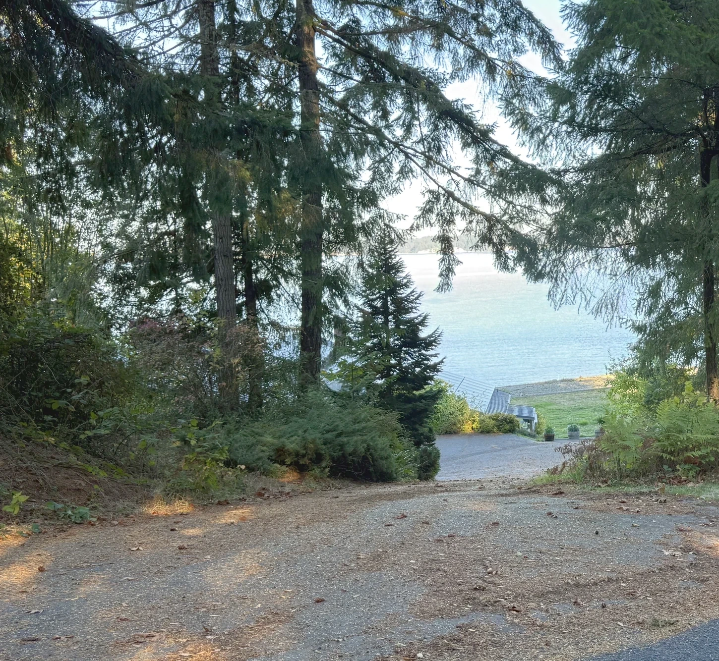
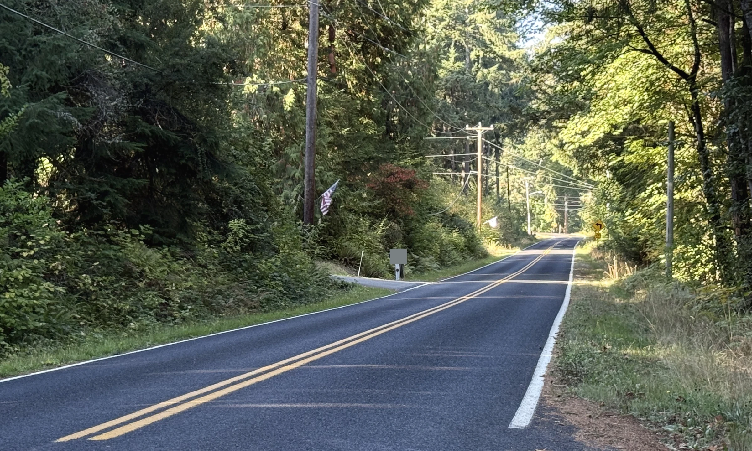
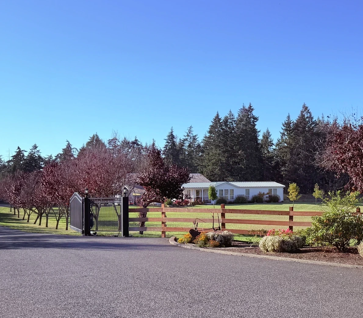
Original photographs by Kyle Murphy. Open a thumbnail for the full view and location caption.
Only if you want the deeper dive
Street-level photos, local history and the detailed housing research are here when you need them.
Get to know the streets
Explore local streets and landmarks. Pins orient you to the area; shaded outlines are city-mapped associations, not the boundaries of this browsing region.
The local map in plain English
A working waterfront landmark
At Zittel’s Marina, the wooded approach opens to covered moorage, boats and water beyond. It is a working waterfront, and that is part of its appeal: this is a place people use, with activity around the docks and boatyard.
Once you leave the marina, the comparison becomes more personal. How much light reaches the house? What does the last stretch of road feel like? Is the water somewhere you can actually go, or simply part of the view?
Test your own route
Drive from the home to the places that organize your week. Notice the last stretch of road, driveway grade, available turning space and how the approach feels after dark.
A wooded setting can create welcome separation between houses while changing daylight and maintenance. Walk the lot and look at those details before making the view the whole decision.
Compare this local guide with the other neighborhoods and pockets in its wider area.
A closer look inside Johnson Point Peninsula
These local profiles surface a useful contrast in construction history, development or property responsibilities. Open the source notes before applying a community-level fact to a specific address.
History & construction
The county research keeps 2 recorded-name groups separate. “BEACHCREST DIV 1” has 30 county records with a year built from 1949–2019, median 1983; sampled residential lots have a 0.14-acre median (30 observations); “BEACHCREST” has 29 county records with a year built from 1955–2010, median 1988; sampled residential lots have a 0.24-acre median (29 observations). These assessor samples help compare building eras, but do not establish the first or last home in a subdivision or the permit history of an individual address.
Open this place profile →Builders & development stages
BARRETT CONSTRUCTION (documented properties in BEACHCREST FIRST ADDITION)
Open this place profile →Inside Johnson Point Peninsula
Compare each place on its own. Builder history, house age, style and ownership arrangements can change between neighboring streets. Recorded-name groups and dated development projects are labeled separately from established communities.
Subdivision
A separate county shoreline association community with managed roads, trails and beach infrastructure.
Construction context: Plat/covenants dated May 1948; association incorporation June 1976. Home years vary.
Development history: Association records date the Beachcrest plat to May 1948 and formation of the association to June 1976. These are different events.Source ↗
Shared rights & responsibilities: Verify membership, beach/tideland rights and infrastructure maintenance.
History: Association records date the Beachcrest plat to May 1948 and formation of the association to June 1976. These are different events.Source ↗
October 10, 2026 research snapshot. These are legal-description search groups, not a count of homes or certified plat boundaries. Divisions, phases and similarly named records remain separate. Year-built fields can include later replacement buildings and non-house property types.
| Recorded name | Year-built sample | Residential lot sample |
|---|---|---|
| BEACHCREST32 named parcel observations | 1955–201029 year observations · median 1988 | 0.24 acres median29 acreage observations |
| BEACHCREST DIV 136 named parcel observations | 1949–201930 year observations · median 1983 | 0.14 acres median30 acreage observations |
Acreage is the median of positive lot-size observations below 100 acres coded RES in the research, not a measurement of every home lot. Samples can be incomplete or overlap; do not add them to calculate community totals. Confirm the actual parcel, original permit, additions and recorded map before relying on a date or size.
Evidence: community documented. Development dates, association formation and individual home completion are separate facts. Research updated October 10, 2026.
Plat records
County parcel records identify Beachcrest First Addition around BEVERLY DR NE, MARIAN DR NE, CAROLE DR NE. Related record names and divisions remain separate until their original maps and governing documents establish the relationship.
Sampled buildings; not a complete buildout history.
Documented builder(s): BARRETT CONSTRUCTION (documented properties in BEACHCREST FIRST ADDITION)
Other builders may also have contributed; not all home and phase records have been reconciled.
Other builders may also have contributed; not all home and phase records have been reconciled. The documented attribution applies only to the community, offering or phase identified above.
October 10, 2026 research snapshot. These are legal-description search groups, not a count of homes or certified plat boundaries. Divisions, phases and similarly named records remain separate. Year-built fields can include later replacement buildings and non-house property types.
| Recorded name | Year-built sample | Residential lot sample |
|---|---|---|
| BEACHCREST FIRST ADDITION224 named parcel observations | 1949–2026184 year observations · median 1987 | 0.19 acres median189 acreage observations |
Acreage is the median of positive lot-size observations below 100 acres coded RES in the research, not a measurement of every home lot. Samples can be incomplete or overlap; do not add them to calculate community totals. Confirm the actual parcel, original permit, additions and recorded map before relying on a date or size.
Evidence: parcel records. Development dates, association formation and individual home completion are separate facts. Research updated October 10, 2026.
Local area
Inland properties can have different utilities and road obligations from shoreline communities.
Evidence: community documented. Development dates, association formation and individual home completion are separate facts.
Local area
The point and marina surroundings are one part of the wider peninsula.
Sampled buildings; not a complete buildout history.
October 10, 2026 research snapshot. These are legal-description search groups, not a count of homes or certified plat boundaries. Divisions, phases and similarly named records remain separate. Year-built fields can include later replacement buildings and non-house property types.
| Recorded name | Year-built sample | Residential lot sample |
|---|---|---|
| JOHNSON POINT105 named parcel observations | 1909–202189 year observations · median 1982 | 1.31 acres median93 acreage observations |
Acreage is the median of positive lot-size observations below 100 acres coded RES in the research, not a measurement of every home lot. Samples can be incomplete or overlap; do not add them to calculate community totals. Confirm the actual parcel, original permit, additions and recorded map before relying on a date or size.
Evidence: community documented. Development dates, association formation and individual home completion are separate facts. Research updated October 10, 2026.
Plat records
County parcel records identify Silver Hawk around SKYLARK ST NE, PLOVER ST NE. Related record names and divisions remain separate until their original maps and governing documents establish the relationship.
Sampled buildings; not a complete buildout history.
October 10, 2026 research snapshot. These are legal-description search groups, not a count of homes or certified plat boundaries. Divisions, phases and similarly named records remain separate. Year-built fields can include later replacement buildings and non-house property types.
| Recorded name | Year-built sample | Residential lot sample |
|---|---|---|
| SILVER HAWK319 named parcel observations | 2016–2026293 year observations · median 2018 | 0.67 acres median294 acreage observations |
Acreage is the median of positive lot-size observations below 100 acres coded RES in the research, not a measurement of every home lot. Samples can be incomplete or overlap; do not add them to calculate community totals. Confirm the actual parcel, original permit, additions and recorded map before relying on a date or size.
Evidence: parcel records. Development dates, association formation and individual home completion are separate facts. Research updated October 10, 2026.
A named place is included even when photographs or a complete builder history are still being gathered. Exact home facts belong to its parcel, plat, permits and current association documents.
Latest neighborhood research · October 10, 2026
The wider region now includes additional recorded-name profiles, distinct divisions and dated development records. Construction-year samples and sourced builder roles belong to the named community or phase—not every home in this local guide.
Explore the updated neighborhood & subdivision directory →What the new records establish
These profiles retain the exact recorded names and the scope of each source.
The point and marina surroundings are one part of the wider peninsula.
October 10, 2026 research snapshot. These are legal-description search groups, not a count of homes or certified plat boundaries. Divisions, phases and similarly named records remain separate. Year-built fields can include later replacement buildings and non-house property types.
| Recorded name | Year-built sample | Residential lot sample |
|---|---|---|
| JOHNSON POINT105 named parcel observations | 1909–202189 year observations · median 1982 | 1.31 acres median93 acreage observations |
Acreage is the median of positive lot-size observations below 100 acres coded RES in the research, not a measurement of every home lot. Samples can be incomplete or overlap; do not add them to calculate community totals. Confirm the actual parcel, original permit, additions and recorded map before relying on a date or size.
Evidence: community documented. Development dates, association formation and individual home completion are separate facts. Research updated October 10, 2026.
The buyer’s side of the story
A Johnson Point location is a starting point for investigation, not a promise of a particular utility or access arrangement.
Confirm driveway, private-road and shoreline rights in title and recorded agreements.
Verify providers or onsite systems and review the records tied to the house.
Connect drainage, roof exposure, trees and retaining features to the inspection.
For a shoreline property, review the parcel’s mapped conditions and recorded obligations with the appropriate specialists.
The honest exchange
Start with the setting, then get specific.
If a wooded approach and waterfront context appeal to you, Johnson Point deserves a closer look. Compare actual homes on light, access, systems and the route you would use each day.
Sources behind this guide
The neighborhood story draws on firsthand observation, local history and reporting. Parcel-level jurisdiction, utilities, hazards and recorded obligations still belong in current public records and transaction documents.
Keep exploring
Your next step, at your pace
I can help you buy a home—from choosing where to look and touring properties to negotiating your offer and navigating closing. Tell me what you’re hoping to find. We’ll talk about working together and make a plan.