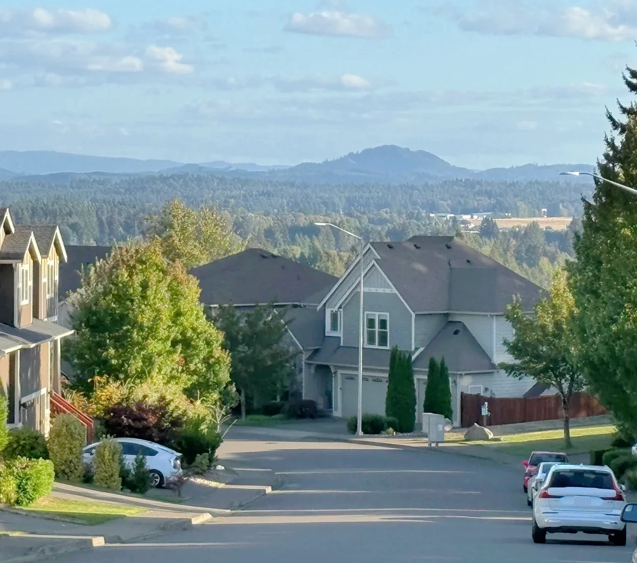
Inside Tumwater Hill
Neighborhoods, subdivisions & smaller places.
Compare each place on its own. Builder history, house age, style and ownership arrangements can change between neighboring streets. Recorded-name groups and dated development projects are labeled separately from established communities.
Local area
Breckenridge Apartments and Breckenridge Heights are separate rental communities in the Somerset/Tumwater Hill setting. Their addresses, reported construction years and advertised outlooks should be read separately; this is not one detached-home subdivision.
Construction context: Breckenridge Apartments at Tuscany Lane is reported as built in 1992 by Apartments.com. A 2016 city-hosted market study lists Breckenridge Heights at Brittany Lane as built in 1994. Keep these separate; original permits and later alterations are not verified here.
Views & outlook: Breckenridge Apartments advertises sunset and mountain outlooks for select units. Breckenridge Heights advertises Olympic Mountain and Black Hills views. These are operator descriptions, not a view guarantee for every unit.
Housing detail: Multifamily rental apartments, with one-, two- and three-bedroom offerings on the communities’ own websites. These sources do not establish individually owned subdivision homes or condominium units for sale.
Shared rights & responsibilities: Rental-community rules, amenity access, parking and charges belong to the particular property and lease. Shared facilities are not public amenities or benefits that transfer to a nearby homeowner.
Housing history, ownership & sources
- Construction history
- Breckenridge Apartments at Tuscany Lane is reported as built in 1992 by Apartments.com. A 2016 city-hosted market study lists Breckenridge Heights at Brittany Lane as built in 1994. Keep these separate; original permits and later alterations are not verified here.
- Housing & styles
- Multifamily rental apartments, with one-, two- and three-bedroom offerings on the communities’ own websites. These sources do not establish individually owned subdivision homes or condominium units for sale.
- Homebuilder
- Original builder has not been established in the sources reviewed.
- Ownership details
- Rental-community rules, amenity access, parking and charges belong to the particular property and lease. Shared facilities are not public amenities or benefits that transfer to a nearby homeowner.
- Views & outlook
- Breckenridge Apartments advertises sunset and mountain outlooks for select units. Breckenridge Heights advertises Olympic Mountain and Black Hills views. These are operator descriptions, not a view guarantee for every unit.
- Location & setting
- Breckenridge Apartments: 2820 Tuscany Lane SW. Breckenridge Heights: 1923 Brittany Lane SW. Both use Tumwater addresses in the Somerset Hill setting.
Evidence: planning record. Development dates, association formation and individual home completion are separate facts.
Subdivision
The appendix locates this development west of RW Johnson and south of Mottman.
Housing history, ownership & sources
- Construction history
- A complete construction range is not yet established; verify the house in Assessor and original permit records.
- Housing & styles
- An architectural style is not inferred from a year-built field. Confirm the actual house and original plans.
- Homebuilder
- Original builder has not been established in the sources reviewed.
Evidence: planning record. Development dates, association formation and individual home completion are separate facts.
Plat records
A Tumwater Hill detached-home development. The county parcel sample has 117 residential year-built values from 2007–2016 (median 2008) and a 0.16-acre median lot; the original builder history is not established by the sources reviewed.
Construction context: County parcel research contains 117 residential year-built observations from 2007–2016, with a median of 2008. This assessed sample does not establish the first or last construction date for the development.
Developer: The original land developer has not been established in the sources reviewed.
Housing detail: The county parcel sample identifies 117 RES-coded observations and a 0.16-acre median residential lot size. Check the specific home, phase, lot and floor plan rather than applying one specification to the whole development.
Housing history, ownership & sources
- Construction history
- County parcel research contains 117 residential year-built observations from 2007–2016, with a median of 2008. This assessed sample does not establish the first or last construction date for the development.
- Residential lot sample
- 0.16 acres median across 117 residential observations. Individual lots vary; this is not a subdivision-wide minimum or maximum.
- Housing & styles
- The county parcel sample identifies 117 RES-coded observations and a 0.16-acre median residential lot size. Check the specific home, phase, lot and floor plan rather than applying one specification to the whole development.
- Developer
- The original land developer has not been established in the sources reviewed.
- Homebuilder
- Original builder has not been established in the sources reviewed.
- Street examples
- RIDGEVIEW LOOP SW. Sample streets, not a boundary or a matched parcel list.
- Parcel-sample jurisdiction
- Tumwater. This reflects the sampled parcels, not every property in the wider browsing region.
Recorded names & construction-year samples (1 record groups)
October 10, 2026 research snapshot. These are legal-description search groups, not a count of homes or certified plat boundaries. Divisions, phases and similarly named records remain separate. Year-built fields can include later replacement buildings and non-house property types.
Acreage is the median of positive lot-size observations below 100 acres coded RES in the research, not a measurement of every home lot. Samples can be incomplete or overlap; do not add them to calculate community totals. Confirm the actual parcel, original permit, additions and recorded map before relying on a date or size.
Evidence: parcel records. Development dates, association formation and individual home completion are separate facts. Research updated October 10, 2026.
Subdivision
The city locates this separate development north of Sapp along RW Johnson.
Housing history, ownership & sources
- Construction history
- A complete construction range is not yet established; verify the house in Assessor and original permit records.
- Housing & styles
- An architectural style is not inferred from a year-built field. Confirm the actual house and original plans.
- Homebuilder
- Original builder has not been established in the sources reviewed.
Evidence: planning record. Development dates, association formation and individual home completion are separate facts.
Subdivision
A separate development within the city’s Tumwater Hill planning context.
Recorded construction samples:- 1981–2010 · 97 year observations · 0.23-acre median residential lot
Sampled buildings; not a complete buildout history.
Housing history, ownership & sources
- Construction history
- 1981–2010 in 97 county year-built observations; median 1986. This is a recorded-building sample, not a complete original buildout chronology.
- Residential lot sample
- 0.23 acres median across 68 residential observations. Individual lots vary; this is not a subdivision-wide minimum or maximum.
- Housing & styles
- An architectural style is not inferred from a year-built field. Confirm the actual house and original plans.
- Homebuilder
- Original builder has not been established in the sources reviewed.
- Street examples
- SW THORPE DR. Sample streets, not a boundary or a matched parcel list.
- Parcel-sample jurisdiction
- Tumwater. This reflects the sampled parcels, not every property in the wider browsing region.
Recorded names & construction-year samples (1 record groups)
October 10, 2026 research snapshot. These are legal-description search groups, not a count of homes or certified plat boundaries. Divisions, phases and similarly named records remain separate. Year-built fields can include later replacement buildings and non-house property types.
Acreage is the median of positive lot-size observations below 100 acres coded RES in the research, not a measurement of every home lot. Samples can be incomplete or overlap; do not add them to calculate community totals. Confirm the actual parcel, original permit, additions and recorded map before relying on a date or size.
Evidence: planning record. Development dates, association formation and individual home completion are separate facts. Research updated October 10, 2026.
Subdivision
Attached housing along Vista Verde Lane; verify the specific community and association for each address.
Housing detail: Attached homes; verify the particular condominium/HOA form.
Shared rights & responsibilities: Review this community’s documents separately from detached-home plats.
Housing history, ownership & sources
- Construction history
- A complete construction range is not yet established; verify the house in Assessor and original permit records.
- Housing & styles
- Attached homes; verify the particular condominium/HOA form.
- Homebuilder
- Original builder has not been established in the sources reviewed.
- Ownership details
- Review this community’s documents separately from detached-home plats.
Evidence: community documented. Development dates, association formation and individual home completion are separate facts.
Plat records
County records place The Overlook at Somerset Hill along Ridgeview Loop SW, Anthem Lane SW and Friday Lane SW. The sample includes 137 residential year-built values from 2008–2013 (median 2012), alongside several other property-type codes; the original builder is not established here.
Construction context: The county parcel sample contains 137 residential year-built observations from 2008–2013, with a median of 2012. This is an assessed sample, not a complete construction chronology.
Developer: The original land developer has not been established in the sources reviewed.
Housing detail: The parcel sample includes RES, APT, REC, LND and other county property-type codes. Confirm the legal lot, unit type and ownership structure for the exact address instead of inferring them from the community name.
Housing history, ownership & sources
- Construction history
- The county parcel sample contains 137 residential year-built observations from 2008–2013, with a median of 2012. This is an assessed sample, not a complete construction chronology.
- Residential lot sample
- 0.08 acres median across 137 residential observations. Individual lots vary; this is not a subdivision-wide minimum or maximum.
- Housing & styles
- The parcel sample includes RES, APT, REC, LND and other county property-type codes. Confirm the legal lot, unit type and ownership structure for the exact address instead of inferring them from the community name.
- Developer
- The original land developer has not been established in the sources reviewed.
- Homebuilder
- Original builder has not been established in the sources reviewed.
- Street examples
- RIDGEVIEW LOOP SW · ANTHEM LN SW · FRIDAY LN SW. Sample streets, not a boundary or a matched parcel list.
- Parcel-sample jurisdiction
- Tumwater. This reflects the sampled parcels, not every property in the wider browsing region.
Recorded names & construction-year samples (1 record groups)
October 10, 2026 research snapshot. These are legal-description search groups, not a count of homes or certified plat boundaries. Divisions, phases and similarly named records remain separate. Year-built fields can include later replacement buildings and non-house property types.
Acreage is the median of positive lot-size observations below 100 acres coded RES in the research, not a measurement of every home lot. Samples can be incomplete or overlap; do not add them to calculate community totals. Confirm the actual parcel, original permit, additions and recorded map before relying on a date or size.
Evidence: parcel records. Development dates, association formation and individual home completion are separate facts. Research updated October 10, 2026.
Plat records
County parcel records identify The Ridge at Suncrest around EBBETS DR SW, G ST SW, LINWOOD AVE SW. Related record names and divisions remain separate until their original maps and governing documents establish the relationship.
Recorded construction samples:- 2008–2012 · 207 year observations · 0.1-acre median residential lot
Sampled buildings; not a complete buildout history.
Housing history, ownership & sources
- Construction history
- 2008–2012 in 207 county year-built observations; median 2011. This is a recorded-building sample, not a complete original buildout chronology.
- Residential lot sample
- 0.1 acres median across 207 residential observations. Individual lots vary; this is not a subdivision-wide minimum or maximum.
- Housing & styles
- An architectural style is not inferred from a year-built field. Confirm the actual house and original plans.
- Homebuilder
- Original builder has not been established in the sources reviewed.
- Street examples
- EBBETS DR SW · G ST SW · LINWOOD AVE SW. Sample streets, not a boundary or a matched parcel list.
- Parcel-sample jurisdiction
- Tumwater. This reflects the sampled parcels, not every property in the wider browsing region.
Recorded names & construction-year samples (1 record groups)
October 10, 2026 research snapshot. These are legal-description search groups, not a count of homes or certified plat boundaries. Divisions, phases and similarly named records remain separate. Year-built fields can include later replacement buildings and non-house property types.
Acreage is the median of positive lot-size observations below 100 acres coded RES in the research, not a measurement of every home lot. Samples can be incomplete or overlap; do not add them to calculate community totals. Confirm the actual parcel, original permit, additions and recorded map before relying on a date or size.
Evidence: parcel records. Development dates, association formation and individual home completion are separate facts. Research updated October 10, 2026.
A named place is included even when photographs or a complete builder history are still being gathered. Exact home facts belong to its parcel, plat, permits and current association documents.