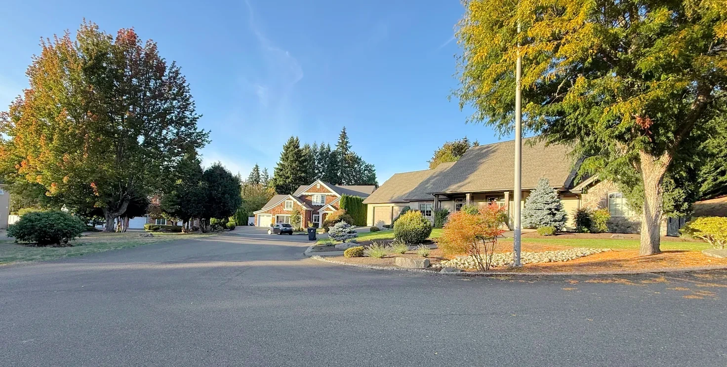
Development project
A separately named residential project in Olympia’s September 2026 development report. Its dated stage is shown below; a proposal or approval does not establish completed or available housing.
Project status: September 2026 city report, entry 24; location: 2817 Boulevard Rd SE; reported quantities: 37 lots, 35 townhomes; stage: townhomes under construction.Source ↗
Housing history, ownership & sources
- Construction history
- A complete construction range is not yet established; verify the house in Assessor and original permit records.
- Housing & styles
- An architectural style is not inferred from a year-built field. Confirm the actual house and original plans.
- Homebuilder
- Original builder has not been established in the sources reviewed.
- Parcel-sample jurisdiction
- Olympia. This reflects the sampled parcels, not every property in the wider browsing region.
- Project stage · dated report
- September 2026 city report, entry 24; location: 2817 Boulevard Rd SE; reported quantities: 37 lots, 35 townhomes; stage: townhomes under construction.Source ↗
Evidence: planning record. Development dates, association formation and individual home completion are separate facts. Research updated October 10, 2026.
Plat records
County parcel records identify Briarwood around AMHURST CT SE, WINTERGARDEN DR SE, BRIARWOOD CT SE, ALLEN ST SE. Related record names and divisions remain separate until their original maps and governing documents establish the relationship.
Recorded construction samples:- BRIARWOOD: 1977–1998 · 29 year observations · 0.26-acre median residential lot
- BRIARWOOD DIV 1: 1986 · 1 year observations · 0.28-acre median residential lot
- BRIARWOOD DIV 2: 1990–2026 · 30 year observations · 0.215-acre median residential lot
2 additional recorded groups in the profile. Sampled buildings; not a complete buildout history.
Housing history, ownership & sources
- Construction history
- BRIARWOOD: 1977–1998 (29 year observations); BRIARWOOD DIV 1: 1986 (1 year observations); BRIARWOOD DIV 2: 1990–2026 (30 year observations). Additional groups appear in the table below. Separate recorded groups, not one combined buildout range.
- Housing & styles
- An architectural style is not inferred from a year-built field. Confirm the actual house and original plans.
- Homebuilder
- Original builder has not been established in the sources reviewed.
- Street examples
- AMHURST CT SE · WINTERGARDEN DR SE · BRIARWOOD CT SE · ALLEN ST SE. Sample streets, not a boundary or a matched parcel list.
- Parcel-sample jurisdiction
- Olympia. This reflects the sampled parcels, not every property in the wider browsing region.
Recorded names & construction-year samples (5 record groups)
October 10, 2026 research snapshot. These are legal-description search groups, not a count of homes or certified plat boundaries. Divisions, phases and similarly named records remain separate. Year-built fields can include later replacement buildings and non-house property types.
Acreage is the median of positive lot-size observations below 100 acres coded RES in the research, not a measurement of every home lot. Samples can be incomplete or overlap; do not add them to calculate community totals. Confirm the actual parcel, original permit, additions and recorded map before relying on a date or size.
Evidence: parcel records. Development dates, association formation and individual home completion are separate facts. Research updated October 10, 2026.
Neighborhood
The association area and nearby established residential streets.
Housing history, ownership & sources
- Construction history
- A complete construction range is not yet established; verify the house in Assessor and original permit records.
- Housing & styles
- An architectural style is not inferred from a year-built field. Confirm the actual house and original plans.
- Homebuilder
- Original builder has not been established in the sources reviewed.
Evidence: community documented. Development dates, association formation and individual home completion are separate facts.
Subdivision
A separately documented southeast subdivision.
Construction context: Development during 1965–1971.
Documented builder(s): Dan Buehler Construction built selected houses.
Other builders may also have contributed; not all home and phase records have been reconciled.
Housing history, ownership & sources
- Construction history
- Development during 1965–1971.
- Housing & styles
- An architectural style is not inferred from a year-built field. Confirm the actual house and original plans.
- Developer
- Russell Schaap
- Homebuilder
- Dan Buehler Construction built selected houses.
- Street examples
- WEDGEWOOD DR SE · DANBURY CT SE · SE VISTA ST · SE VISTA AVE. Sample streets, not a boundary or a matched parcel list.
- Parcel-sample jurisdiction
- Olympia. This reflects the sampled parcels, not every property in the wider browsing region.
- Developer
- Russell Schaap developed Canterbury during 1965–1971.Source ↗
- Homebuilder · documented offering
- Dan Buehler built several houses; original permits are needed for house-specific attribution.Source ↗
Other builders may also have contributed; not all home and phase records have been reconciled. The documented attribution applies only to the community, offering or phase identified above.
Recorded names & construction-year samples (9 record groups)
October 10, 2026 research snapshot. These are legal-description search groups, not a count of homes or certified plat boundaries. Divisions, phases and similarly named records remain separate. Year-built fields can include later replacement buildings and non-house property types.
Acreage is the median of positive lot-size observations below 100 acres coded RES in the research, not a measurement of every home lot. Samples can be incomplete or overlap; do not add them to calculate community totals. Confirm the actual parcel, original permit, additions and recorded map before relying on a date or size.
Evidence: history documented. Development dates, association formation and individual home completion are separate facts. Research updated October 10, 2026.
Subdivision
A documented mid-century development near Cain Road.
Construction context: Development began in 1955.
Documented builder(s): Berschauer Construction built selected houses.
Other builders may also have contributed; not all home and phase records have been reconciled.
Design history: Robert Wohleb designed the 1959 Gorrell house at 1901 Eastwood; other houses require separate attribution.Source ↗
Housing history, ownership & sources
- Construction history
- Development began in 1955.
- Housing & styles
- An architectural style is not inferred from a year-built field. Confirm the actual house and original plans.
- Developer
- Virgil Adams
- Homebuilder
- Berschauer Construction built selected houses.
- Developer
- Virgil Adams developed Forest Hills beginning in 1955.Source ↗
- Homebuilder · documented offering
- Berschauer built several documented houses; this is not an attribution of every house.Source ↗
- Architecture · documented project
- Robert Wohleb designed the 1959 Gorrell house at 1901 Eastwood; other houses require separate attribution.Source ↗
Other builders may also have contributed; not all home and phase records have been reconciled. The documented attribution applies only to the community, offering or phase identified above.
Evidence: history documented. Development dates, association formation and individual home completion are separate facts. Research updated October 10, 2026.
Plat records
County parcel records identify Forestglen around SE YEW WOOD CT, YEW WOOD CT SE, RUMAC ST SE, SE RUMAC ST. Related record names and divisions remain separate until their original maps and governing documents establish the relationship.
Recorded construction samples:- FOREST GLEN: 1972–1979 · 15 year observations · 0.275-acre median residential lot
- FORESTGLEN DIV 1: 1972–1975 · 14 year observations · 0.25-acre median residential lot
- FORESTGLEN DIV 2: 1973–2019 · 20 year observations · 0.29-acre median residential lot
4 additional recorded groups in the profile. Sampled buildings; not a complete buildout history.
Housing history, ownership & sources
- Construction history
- FOREST GLEN: 1972–1979 (15 year observations); FORESTGLEN DIV 1: 1972–1975 (14 year observations); FORESTGLEN DIV 2: 1973–2019 (20 year observations). Additional groups appear in the table below. Separate recorded groups, not one combined buildout range.
- Housing & styles
- An architectural style is not inferred from a year-built field. Confirm the actual house and original plans.
- Homebuilder
- Original builder has not been established in the sources reviewed.
- Street examples
- SE YEW WOOD CT · YEW WOOD CT SE · RUMAC ST SE · SE RUMAC ST. Sample streets, not a boundary or a matched parcel list.
- Parcel-sample jurisdiction
- Unincorporated Thurston County · Lacey. This reflects the sampled parcels, not every property in the wider browsing region.
Recorded names & construction-year samples (7 record groups)
October 10, 2026 research snapshot. These are legal-description search groups, not a count of homes or certified plat boundaries. Divisions, phases and similarly named records remain separate. Year-built fields can include later replacement buildings and non-house property types.
Acreage is the median of positive lot-size observations below 100 acres coded RES in the research, not a measurement of every home lot. Samples can be incomplete or overlap; do not add them to calculate community totals. Confirm the actual parcel, original permit, additions and recorded map before relying on a date or size.
Evidence: parcel records. Development dates, association formation and individual home completion are separate facts. Research updated October 10, 2026.
Subdivision
Greenfield Estates brings late-1990s detached-home streets and a documented homeowners association to the Hoffman Road side of southeast Olympia.
Construction context: County residential sample: 78 year-built values, 1997–2002, median 1998. This is assessor context, not a certified buildout history.
Documented builder(s): Not established in the primary sources reviewed. Original permits and lot-specific construction records are needed before attributing a builder.
Other builders may also have contributed; not all home and phase records have been reconciled.
Housing detail: Detached-home subdivision; the 78 residential lots sampled have a 0.15-acre median. Individual size, layout and usable yard vary.
Shared rights & responsibilities: Recognized homeowners association. Verify the home’s membership, current dues, budget, reserves, insurance, rules and shared-maintenance obligations from current documents.
Housing history, ownership & sources
- Construction history
- County residential sample: 78 year-built values, 1997–2002, median 1998. This is assessor context, not a certified buildout history.
- Residential lot sample
- 0.15 acres median across 78 residential observations. Individual lots vary; this is not a subdivision-wide minimum or maximum.
- Housing & styles
- Detached-home subdivision; the 78 residential lots sampled have a 0.15-acre median. Individual size, layout and usable yard vary.
- Homebuilder
- Not established in the primary sources reviewed. Original permits and lot-specific construction records are needed before attributing a builder.
- Ownership details
- Recognized homeowners association. Verify the home’s membership, current dues, budget, reserves, insurance, rules and shared-maintenance obligations from current documents.
- Location & setting
- County records group Greenfield divisions under the GREENFIELD plat name, including Greenfield Street, Kyle Street, 22nd Avenue, Joshua Way and Nissing Way SE. The association publishes separate Division One and Division Two plats.
- Street examples
- Greenfield Street SE · Kyle Street SE · 22nd Avenue SE · Joshua Way SE · Nissing Way SE. Sample streets, not a boundary or a matched parcel list.
Other builders may also have contributed; not all home and phase records have been reconciled. The documented attribution applies only to the community, offering or phase identified above.
Recorded names & construction-year samples (1 record groups)
October 10, 2026 research snapshot. These are legal-description search groups, not a count of homes or certified plat boundaries. Divisions, phases and similarly named records remain separate. Year-built fields can include later replacement buildings and non-house property types.
Acreage is the median of positive lot-size observations below 100 acres coded RES in the research, not a measurement of every home lot. Samples can be incomplete or overlap; do not add them to calculate community totals. Confirm the actual parcel, original permit, additions and recorded map before relying on a date or size.
Evidence: community documented. Development dates, association formation and individual home completion are separate facts. Research updated October 10, 2026.
Development project
A separately named residential project in Olympia’s September 2026 development report. Its dated stage is shown below; a proposal or approval does not establish completed or available housing.
Project status: September 2026 city report, entry 11; location: 3900 Boulevard Road SE; reported quantities: see original report; stage: engineering permit issued March 2026.Source ↗
Housing history, ownership & sources
- Construction history
- A complete construction range is not yet established; verify the house in Assessor and original permit records.
- Housing & styles
- An architectural style is not inferred from a year-built field. Confirm the actual house and original plans.
- Homebuilder
- Original builder has not been established in the sources reviewed.
- Parcel-sample jurisdiction
- Olympia. This reflects the sampled parcels, not every property in the wider browsing region.
- Project stage · dated report
- September 2026 city report, entry 11; location: 3900 Boulevard Road SE; reported quantities: see original report; stage: engineering permit issued March 2026.Source ↗
Evidence: planning record. Development dates, association formation and individual home completion are separate facts. Research updated October 10, 2026.
Subdivision
A separately recognized community in the southeast residential area.
Housing history, ownership & sources
- Construction history
- A complete construction range is not yet established; verify the house in Assessor and original permit records.
- Housing & styles
- An architectural style is not inferred from a year-built field. Confirm the actual house and original plans.
- Homebuilder
- Original builder has not been established in the sources reviewed.
Evidence: community documented. Development dates, association formation and individual home completion are separate facts.
Development project
A separately named residential project in Olympia’s September 2026 development report. Its dated stage is shown below; a proposal or approval does not establish completed or available housing.
Project status: September 2026 city report, entry 32; location: 1567 Ontario St SE; reported quantities: 8 residential lots; stage: under preliminary subdivision review.Source ↗
Housing history, ownership & sources
- Construction history
- A complete construction range is not yet established; verify the house in Assessor and original permit records.
- Housing & styles
- An architectural style is not inferred from a year-built field. Confirm the actual house and original plans.
- Homebuilder
- Original builder has not been established in the sources reviewed.
- Parcel-sample jurisdiction
- Olympia. This reflects the sampled parcels, not every property in the wider browsing region.
- Project stage · dated report
- September 2026 city report, entry 32; location: 1567 Ontario St SE; reported quantities: 8 residential lots; stage: under preliminary subdivision review.Source ↗
Evidence: planning record. Development dates, association formation and individual home completion are separate facts. Research updated October 10, 2026.
Subdivision
Redwood Estates is a defined southeast Olympia subdivision on Redwood Place SE. County records point to a concentrated late-1990s housing sample rather than a large, mixed-era district.
Construction context: County residential sample: 35 year-built values, 1996–1999, median 1997. This is assessor context, not a certified buildout history.
Documented builder(s): Not established in the primary sources reviewed. Original permits and lot-specific construction records are needed before attributing a builder.
Other builders may also have contributed; not all home and phase records have been reconciled.
Housing detail: Detached-home subdivision; the 35 residential lots sampled have a 0.18-acre median. Individual size, layout and usable yard vary.
Shared rights & responsibilities: Recognized homeowners association. Verify the home’s membership, current dues, budget, reserves, insurance, rules and shared-maintenance obligations from current documents.
Housing history, ownership & sources
- Construction history
- County residential sample: 35 year-built values, 1996–1999, median 1997. This is assessor context, not a certified buildout history.
- Residential lot sample
- 0.18 acres median across 35 residential observations. Individual lots vary; this is not a subdivision-wide minimum or maximum.
- Housing & styles
- Detached-home subdivision; the 35 residential lots sampled have a 0.18-acre median. Individual size, layout and usable yard vary.
- Homebuilder
- Not established in the primary sources reviewed. Original permits and lot-specific construction records are needed before attributing a builder.
- Ownership details
- Recognized homeowners association. Verify the home’s membership, current dues, budget, reserves, insurance, rules and shared-maintenance obligations from current documents.
- Location & setting
- The REDWOOD ESTATES recorded-name sample follows Redwood Place SE. It is a smaller community within the southeast Olympia browsing area, not a label for all nearby streets.
- Street examples
- Redwood Place SE. Sample streets, not a boundary or a matched parcel list.
Other builders may also have contributed; not all home and phase records have been reconciled. The documented attribution applies only to the community, offering or phase identified above.
Recorded names & construction-year samples (1 record groups)
October 10, 2026 research snapshot. These are legal-description search groups, not a count of homes or certified plat boundaries. Divisions, phases and similarly named records remain separate. Year-built fields can include later replacement buildings and non-house property types.
Acreage is the median of positive lot-size observations below 100 acres coded RES in the research, not a measurement of every home lot. Samples can be incomplete or overlap; do not add them to calculate community totals. Confirm the actual parcel, original permit, additions and recorded map before relying on a date or size.
Evidence: community documented. Development dates, association formation and individual home completion are separate facts. Research updated October 10, 2026.
Plat records
County parcel records identify Rossmoor around GRAMPIN CT SE, SE 28TH AVE, BOULEVARD RD SE, PERTH CT SE. Related record names and divisions remain separate until their original maps and governing documents establish the relationship.
Recorded construction samples:- ROSSMOOR: 1980–1982 · 3 year observations · 0.32-acre median residential lot
- ROSSMOOR DIV 1: 1980–2007 · 40 year observations · 0.22-acre median residential lot
- ROSSMOOR DIV 2: 1997–2005 · 63 year observations · 0.23-acre median residential lot
Sampled buildings; not a complete buildout history.
Housing history, ownership & sources
- Construction history
- ROSSMOOR: 1980–1982 (3 year observations); ROSSMOOR DIV 1: 1980–2007 (40 year observations); ROSSMOOR DIV 2: 1997–2005 (63 year observations). Separate recorded groups, not one combined buildout range.
- Housing & styles
- An architectural style is not inferred from a year-built field. Confirm the actual house and original plans.
- Homebuilder
- Original builder has not been established in the sources reviewed.
- Street examples
- GRAMPIN CT SE · SE 28TH AVE · BOULEVARD RD SE · PERTH CT SE. Sample streets, not a boundary or a matched parcel list.
- Parcel-sample jurisdiction
- Olympia. This reflects the sampled parcels, not every property in the wider browsing region.
Recorded names & construction-year samples (4 record groups)
October 10, 2026 research snapshot. These are legal-description search groups, not a count of homes or certified plat boundaries. Divisions, phases and similarly named records remain separate. Year-built fields can include later replacement buildings and non-house property types.
Acreage is the median of positive lot-size observations below 100 acres coded RES in the research, not a measurement of every home lot. Samples can be incomplete or overlap; do not add them to calculate community totals. Confirm the actual parcel, original permit, additions and recorded map before relying on a date or size.
Evidence: parcel records. Development dates, association formation and individual home completion are separate facts. Research updated October 10, 2026.
Development project
A separately named residential project in Olympia’s September 2026 development report. Its dated stage is shown below; a proposal or approval does not establish completed or available housing.
Project status: September 2026 city report, entry 19; location: 3714 Royal Street SE; reported quantities: see original report; stage: under engineering and building permit review.Source ↗
Housing history, ownership & sources
- Construction history
- A complete construction range is not yet established; verify the house in Assessor and original permit records.
- Housing & styles
- An architectural style is not inferred from a year-built field. Confirm the actual house and original plans.
- Homebuilder
- Original builder has not been established in the sources reviewed.
- Parcel-sample jurisdiction
- Olympia. This reflects the sampled parcels, not every property in the wider browsing region.
- Project stage · dated report
- September 2026 city report, entry 19; location: 3714 Royal Street SE; reported quantities: see original report; stage: under engineering and building permit review.Source ↗
Evidence: planning record. Development dates, association formation and individual home completion are separate facts. Research updated October 10, 2026.
Plat records
County parcel records identify Shana Park around CLEARFIELD DR SE, DOVER CT SE, NORMANDY DR SE, CLEARFIELD CT SE. Related record names and divisions remain separate until their original maps and governing documents establish the relationship.
Recorded construction samples:- SHANA PARK: 1972–1990 · 9 year observations · 0.25-acre median residential lot
- SHANA PARK DIV 1: 1972–1991 · 38 year observations · 0.23-acre median residential lot
- SHANA PARK DIV 2: 1972–1991 · 33 year observations · 0.23-acre median residential lot
2 additional recorded groups in the profile. Sampled buildings; not a complete buildout history.
Housing history, ownership & sources
- Construction history
- SHANA PARK: 1972–1990 (9 year observations); SHANA PARK DIV 1: 1972–1991 (38 year observations); SHANA PARK DIV 2: 1972–1991 (33 year observations). Additional groups appear in the table below. Separate recorded groups, not one combined buildout range.
- Housing & styles
- An architectural style is not inferred from a year-built field. Confirm the actual house and original plans.
- Homebuilder
- Original builder has not been established in the sources reviewed.
- Street examples
- CLEARFIELD DR SE · DOVER CT SE · NORMANDY DR SE · CLEARFIELD CT SE. Sample streets, not a boundary or a matched parcel list.
- Parcel-sample jurisdiction
- Unincorporated Thurston County · Olympia. This reflects the sampled parcels, not every property in the wider browsing region.
Recorded names & construction-year samples (5 record groups)
October 10, 2026 research snapshot. These are legal-description search groups, not a count of homes or certified plat boundaries. Divisions, phases and similarly named records remain separate. Year-built fields can include later replacement buildings and non-house property types.
Acreage is the median of positive lot-size observations below 100 acres coded RES in the research, not a measurement of every home lot. Samples can be incomplete or overlap; do not add them to calculate community totals. Confirm the actual parcel, original permit, additions and recorded map before relying on a date or size.
Evidence: parcel records. Development dates, association formation and individual home completion are separate facts. Research updated October 10, 2026.
Subdivision
A separate 24-home Rob Rice community.
Documented builder(s): Rob Rice Homes (marketed brand)
Other builders may also have contributed; not all home and phase records have been reconciled.
Housing detail: Published two-story plans, 2,432–2,692 sq ft; features vary by home.
Housing history, ownership & sources
- Construction history
- A complete construction range is not yet established; verify the house in Assessor and original permit records.
- Housing & styles
- Published two-story plans, 2,432–2,692 sq ft; features vary by home.
- Homebuilder
- Rob Rice Homes (marketed brand)
- Homebuilder · documented offering
- Rob Rice Homes markets/builds this named community. Applicable recorded divisions, developing legal entity and house-specific permits must be verified; this is not an attribution of every resale house.Source ↗
Other builders may also have contributed; not all home and phase records have been reconciled. The documented attribution applies only to the community, offering or phase identified above.
Evidence: community documented. Development dates, association formation and individual home completion are separate facts. Research updated October 10, 2026.
Plat records
County parcel records identify Whisper Ridge around SOLITUDE ST SE, SE SOLITUDE ST, SE SUGARLOAF LN, POWDER RIDGE ST SE. Related record names and divisions remain separate until their original maps and governing documents establish the relationship.
Recorded construction samples:- WHISPER RIDGE DIV 1: 1998–2003 · 39 year observations · 0.1-acre median residential lot
- WHISPER RIDGE DIV 2: 1999–2003 · 55 year observations · 0.09-acre median residential lot
Sampled buildings; not a complete buildout history.
Housing history, ownership & sources
- Construction history
- WHISPER RIDGE DIV 1: 1998–2003 (39 year observations); WHISPER RIDGE DIV 2: 1999–2003 (55 year observations). Separate recorded groups, not one combined buildout range.
- Housing & styles
- An architectural style is not inferred from a year-built field. Confirm the actual house and original plans.
- Homebuilder
- Original builder has not been established in the sources reviewed.
- Street examples
- SOLITUDE ST SE · SE SOLITUDE ST · SE SUGARLOAF LN · POWDER RIDGE ST SE. Sample streets, not a boundary or a matched parcel list.
- Parcel-sample jurisdiction
- Olympia. This reflects the sampled parcels, not every property in the wider browsing region.
Recorded names & construction-year samples (4 record groups)
October 10, 2026 research snapshot. These are legal-description search groups, not a count of homes or certified plat boundaries. Divisions, phases and similarly named records remain separate. Year-built fields can include later replacement buildings and non-house property types.
Acreage is the median of positive lot-size observations below 100 acres coded RES in the research, not a measurement of every home lot. Samples can be incomplete or overlap; do not add them to calculate community totals. Confirm the actual parcel, original permit, additions and recorded map before relying on a date or size.
Evidence: parcel records. Development dates, association formation and individual home completion are separate facts. Research updated October 10, 2026.
Subdivision
A distinct property-owners association community in the southeast area.
Recorded construction samples:- WILDERNESS DIV 10: 1976–1977 · 7 year observations · 0.3-acre median residential lot
- WILDERNESS DIV 13: 1991 · 1 year observations
- WILDERNESS DIV 14: 1977–1980 · 11 year observations · 0.3-acre median residential lot
12 additional recorded groups in the profile. Sampled buildings; not a complete buildout history.
Housing history, ownership & sources
- Construction history
- WILDERNESS DIV 10: 1976–1977 (7 year observations); WILDERNESS DIV 13: 1991 (1 year observations); WILDERNESS DIV 14: 1977–1980 (11 year observations). Additional groups appear in the table below. Separate recorded groups, not one combined buildout range.
- Housing & styles
- An architectural style is not inferred from a year-built field. Confirm the actual house and original plans.
- Homebuilder
- Original builder has not been established in the sources reviewed.
- Street examples
- SE WILDERNESS DR · SE 45TH AVE · DONAVAN DR SE · FIRWOOD LOOP SE. Sample streets, not a boundary or a matched parcel list.
- Parcel-sample jurisdiction
- Unincorporated Thurston County. This reflects the sampled parcels, not every property in the wider browsing region.
Recorded names & construction-year samples (20 record groups)
October 10, 2026 research snapshot. These are legal-description search groups, not a count of homes or certified plat boundaries. Divisions, phases and similarly named records remain separate. Year-built fields can include later replacement buildings and non-house property types.
Acreage is the median of positive lot-size observations below 100 acres coded RES in the research, not a measurement of every home lot. Samples can be incomplete or overlap; do not add them to calculate community totals. Confirm the actual parcel, original permit, additions and recorded map before relying on a date or size.
Evidence: community documented. Development dates, association formation and individual home completion are separate facts. Research updated October 10, 2026.
Subdivision
Woodfield Loop, also known as Woodfield Estates, is a 67-lot community on an enclosed loop near Chambers Lake. The HOA describes a central playground, established trees and green spaces.
Construction context: County residential sample: 67 year-built values, 1991–1994, median 1992. This is assessor context, not a certified buildout history.
Documented builder(s): Not established in the primary sources reviewed. Original permits and lot-specific construction records are needed before attributing a builder.
Other builders may also have contributed; not all home and phase records have been reconciled.
Housing detail: Detached-home subdivision; the 67 residential lots sampled have a 0.19-acre median. Individual size, layout and usable yard vary.
Shared rights & responsibilities: Recognized homeowners association. Verify the home’s membership, current dues, budget, reserves, insurance, rules and shared-maintenance obligations from current documents.
Housing history, ownership & sources
- Construction history
- County residential sample: 67 year-built values, 1991–1994, median 1992. This is assessor context, not a certified buildout history.
- Residential lot sample
- 0.19 acres median across 67 residential observations. Individual lots vary; this is not a subdivision-wide minimum or maximum.
- Housing & styles
- Detached-home subdivision; the 67 residential lots sampled have a 0.19-acre median. Individual size, layout and usable yard vary.
- Homebuilder
- Not established in the primary sources reviewed. Original permits and lot-specific construction records are needed before attributing a builder.
- Ownership details
- Recognized homeowners association. Verify the home’s membership, current dues, budget, reserves, insurance, rules and shared-maintenance obligations from current documents.
- Location & setting
- The June 2026 city roster calls the association Woodfield Loop HOA; the community’s own website and county plat use Woodfield Estates. These names are kept together as one profile, separate from other WOODFIELD records elsewhere in Thurston County.
- Street examples
- Woodfield Loop SE · Woodfield Lane SE. Sample streets, not a boundary or a matched parcel list.
Other builders may also have contributed; not all home and phase records have been reconciled. The documented attribution applies only to the community, offering or phase identified above.
Recorded names & construction-year samples (1 record groups)
October 10, 2026 research snapshot. These are legal-description search groups, not a count of homes or certified plat boundaries. Divisions, phases and similarly named records remain separate. Year-built fields can include later replacement buildings and non-house property types.
Acreage is the median of positive lot-size observations below 100 acres coded RES in the research, not a measurement of every home lot. Samples can be incomplete or overlap; do not add them to calculate community totals. Confirm the actual parcel, original permit, additions and recorded map before relying on a date or size.
Evidence: community documented. Development dates, association formation and individual home completion are separate facts. Research updated October 10, 2026.
Plat records
County parcel records identify Woodsmuir around SE SHADLEWOOD CT, GLENDALE DR SE, SE WINDEMERE DR, DONNELLY DR SE. Related record names and divisions remain separate until their original maps and governing documents establish the relationship.
Recorded construction samples:- WOODSMUIR: 1969–1977 · 22 year observations · 0.34-acre median residential lot
- WOODSMUIR DIV 1: 1969–1977 · 22 year observations · 0.25-acre median residential lot
- WOODSMUIR DIV 2: 1969–1979 · 21 year observations · 0.29-acre median residential lot
3 additional recorded groups in the profile. Sampled buildings; not a complete buildout history.
Housing history, ownership & sources
- Construction history
- WOODSMUIR: 1969–1977 (22 year observations); WOODSMUIR DIV 1: 1969–1977 (22 year observations); WOODSMUIR DIV 2: 1969–1979 (21 year observations). Additional groups appear in the table below. Separate recorded groups, not one combined buildout range.
- Housing & styles
- An architectural style is not inferred from a year-built field. Confirm the actual house and original plans.
- Homebuilder
- Original builder has not been established in the sources reviewed.
- Street examples
- SE SHADLEWOOD CT · GLENDALE DR SE · SE WINDEMERE DR · DONNELLY DR SE. Sample streets, not a boundary or a matched parcel list.
- Parcel-sample jurisdiction
- Unincorporated Thurston County. This reflects the sampled parcels, not every property in the wider browsing region.
Recorded names & construction-year samples (6 record groups)
October 10, 2026 research snapshot. These are legal-description search groups, not a count of homes or certified plat boundaries. Divisions, phases and similarly named records remain separate. Year-built fields can include later replacement buildings and non-house property types.
Acreage is the median of positive lot-size observations below 100 acres coded RES in the research, not a measurement of every home lot. Samples can be incomplete or overlap; do not add them to calculate community totals. Confirm the actual parcel, original permit, additions and recorded map before relying on a date or size.
Evidence: parcel records. Development dates, association formation and individual home completion are separate facts. Research updated October 10, 2026.
A named place is included even when photographs or a complete builder history are still being gathered. Exact home facts belong to its parcel, plat, permits and current association documents.